ROHIT MATHUR
REALTOR® | Fraser Valley, BC
 LPT Realty ULC

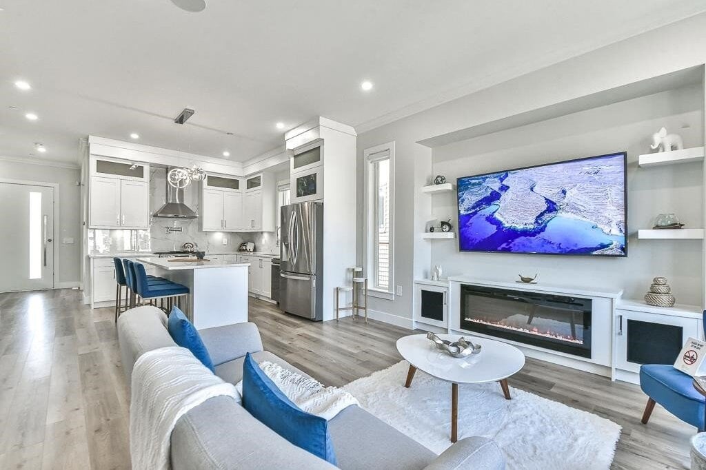
Bliss At Latimer Showhome. Fully furnished luxury half-duplex in Langley featuring 5 bedrooms, 5 bathrooms, designer custom millwork, open-concept living, and chef's kitchen.
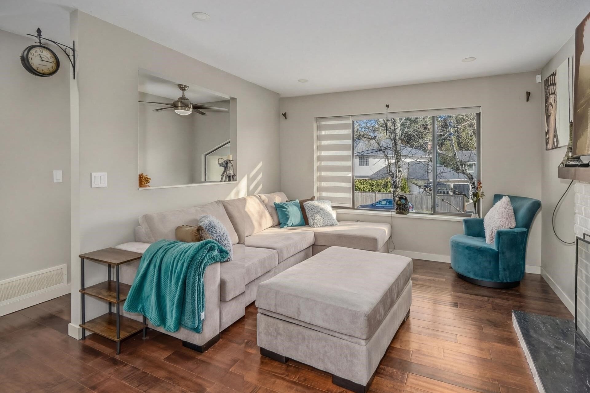
Spacious single-family home on a 7,253 sq. ft. lot in Surrey's King George Corridor. Features a 2-bedroom basement suite with separate entrance, open kitchen, and private deck.
Discover what makes each neighbourhood unique, from vibrant city centers to serene suburban retreats.
Submit your coordinates to schedule a private advisory consultation.
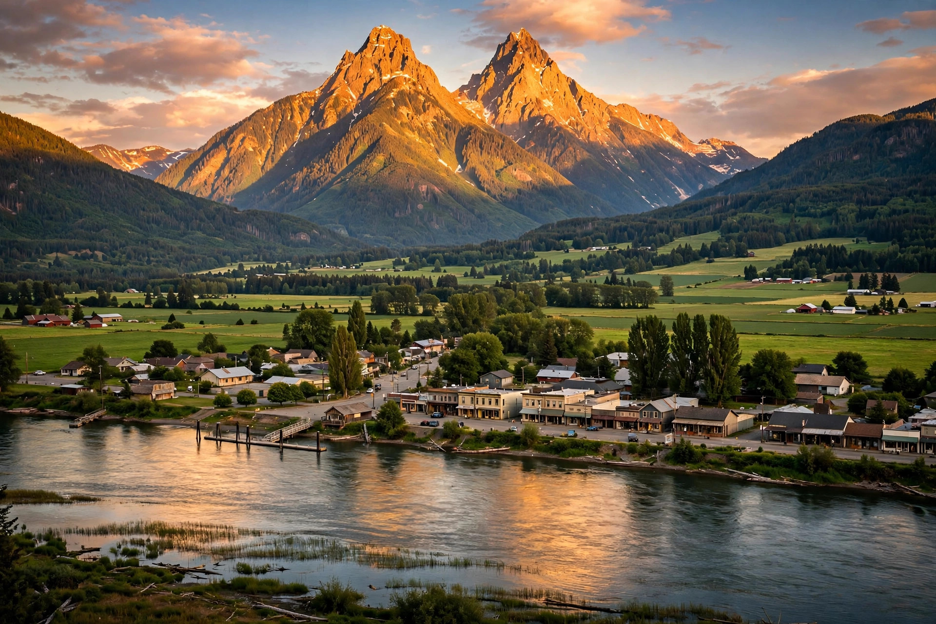
Maple Ridge sits on the north bank of the Fraser River, about 45 kilometres east of Vancouver, in the shadow of the Golden Ears peaks. It is home to 90,990 people (2021 Census) across a big, varied land base of 267.8 square kilometres - a compact heritage downtown in Haney, fast-growing subdivisions in Albion and Cottonwood, a historic mill town in Hammond, and genuine acreage country in Silver Valley, Ruskin, and Webster's Corners.
The city grew up on the river and the railway: Port Haney was a Fraser River port, Hammond was founded in the 1880s around its cedar mill, and farming filled the flatlands in between. The modern turning points were the Golden Ears Bridge in 2009, which tied Maple Ridge directly to Langley and Surrey, and a decade of young families arriving for the same reason - this is one of the last places in Metro Vancouver where a detached house on a real lot still comes at a comparatively reachable price, with a provincial park as the backyard.
Albion - The fast-growing east side: newer subdivisions and townhomes around Samuel Robertson Technical School and Albion Elementary, with Kanaka Creek Regional Park on the doorstep. The old Albion Ferry landing is here - the ferry crossed to Fort Langley until the Golden Ears Bridge replaced it in 2009. A first call for families who want a newer home.
Haney - The downtown core and the city's historic heart. Haney Place Mall, Memorial Peace Park, the ACT Arts Centre, and heritage buildings along 224th Street, with a mix of older homes, low-rise condos, and new infill. Thomas Haney Secondary and Maple Ridge Secondary are both close, and the Haney Farmers Market runs in the park through the season.
Hammond - A heritage mill town founded in the 1880s, just west of downtown near the Pitt Meadows border. Character homes on quiet streets, Hammond Park, pool, and stadium, and a strong small-community feel. The Golden Ears Bridge is minutes away, which makes Hammond a quiet bargain for commuters heading south of the river.
Ruskin - Rural Maple Ridge at its far east end, where the Stave River meets the Fraser. Acreages, farms, and riverfront along the Ruskin Dam and Hayward Lake recreation area. This is small-holding and equestrian country - privacy and land, about 15 minutes east of downtown Haney.
Silver Valley - The city's rural north: large lots, newer estate homes mixed with long-time acreages, and trail networks running into the hills below Golden Ears Provincial Park. The UBC Malcolm Knapp Research Forest borders the area. Buyers come here for space and quiet while keeping a 15-minute drive to shops.
Thornhill - A hillside neighbourhood in the southeast with views over the Fraser River and valley. Established family homes and acreages on winding, treed streets, with equestrian trails throughout. Close to Webster's Corners and the 272nd Street route down to the Lougheed Highway.
Webster's Corners - Farming country in the east, around Webster's Corners Elementary and Garibaldi Secondary. Acreages, hobby farms, and family homes on big lots, with Kanaka Creek's waterfalls and trails nearby. One of the best-value acreage areas left in Metro Vancouver.
Maple Ridge is served by School District 42 (Maple Ridge-Pitt Meadows). Secondary schools include Maple Ridge Secondary and Thomas Haney Secondary near the downtown core, Garibaldi Secondary in the east, Westview Secondary in the west, and Samuel Robertson Technical in Albion, a trades-focused school that draws students from across the district. Elementary schools serve every neighbourhood, including Albion, Hammond, Webster's Corners, Whonnock, and Yennadon. BCIT and other post-secondary options are a commute away, and the West Coast Express makes downtown Vancouver campuses practical.
Maple Ridge has no SkyTrain - the West Coast Express is the transit backbone, with two stations in the city: Maple Meadows (with a large park-and-ride) and Port Haney, reaching downtown Vancouver's Waterfront Station in about an hour on weekday peak trains. Drivers use the Lougheed Highway west through Pitt Meadows and Coquitlam, Highway 1 via the Port Mann Bridge, or the Golden Ears Bridge south to Langley and Surrey in about 15 minutes. Budget roughly 45-70 minutes to Vancouver by car depending on the hour - the tradeoff for the lower house prices is a longer drive than the SkyTrain suburbs.
The outdoors run this town. Golden Ears Provincial Park - one of the largest parks in BC - starts at the city's north edge, with Alouette Lake for swimming, boating, and camping, and dozens of trails from easy lakefront walks to serious alpine routes. Kanaka Creek Regional Park adds waterfalls, salmon viewing, and cliff trails in the east, and the Fraser River dikes give cyclists and riders a flat, scenic network year-round.
In town, the ACT Arts Centre anchors arts and theatre, Memorial Peace Park hosts Canada Day and the annual Celebrate the Night festival and fireworks, the Maple Ridge Leisure Centre and Planet Ice cover recreation, and the Haney Farmers Market fills the park on market days. Equestrian culture is real here - arenas, barns, and trail access are part of daily life in the eastern neighbourhoods - and the Port Haney Wharf and Haney House Museum keep the river heritage visible.
Maple Ridge is covered by Greater Vancouver REALTORS rather than the Fraser Valley board, so its numbers come from the Metro Vancouver report. GVR's activity summary groups Maple Ridge with Pitt Meadows, and together they recorded 107 sales and 312 new listings in September 2026. Maple Ridge's own September 2026 benchmark prices tell the value story: detached homes at $1,155,900 (down 7.7% from a year ago), townhouses at $700,800 (down 8.1%), and apartments at $513,400 (down 2.6%), with a composite benchmark of $882,600 (down 7.0%). Against a Greater Vancouver detached benchmark of $1,784,700, that detached number - roughly $630,000 lower - is exactly why Maple Ridge keeps pulling families east: a full family home, a bigger lot, and mountains out the window, at the cost of a longer commute. (Source: Greater Vancouver REALTORS, September 2026)
Is Maple Ridge part of the Fraser Valley?
Geographically it looks east, but for real estate Maple Ridge is a Metro Vancouver city covered by Greater Vancouver REALTORS, not the Fraser Valley board - the Fraser River and the Golden Ears Bridge connect it to both worlds. Rohit helps buyers and sellers on both sides of that line.
How long is the commute from Maple Ridge to Vancouver?
About an hour downtown on the West Coast Express from Maple Meadows or Port Haney, or roughly 45-70 minutes by car via the Lougheed Highway and Highway 1, depending on traffic.
Which Maple Ridge neighbourhood is best for families?
Albion and Cottonwood are the newer-home picks close to schools and downtown; Hammond and Haney suit buyers who want character and lower prices; Silver Valley, Ruskin, and Webster's Corners are the acreage options.
Is Maple Ridge affordable by Metro Vancouver standards?
It is one of the region's value leaders: a detached benchmark of about $1.16 million and an apartment benchmark of about $513,400 (September 2026), both well below the Metro Vancouver averages.
What is Golden Ears Provincial Park?
One of BC's largest provincial parks, directly north of the city - Alouette Lake beaches and boat launches, campgrounds, and a major trail network under the Golden Ears peaks. For many residents it is the main reason to live here.
Questions about a specific Maple Ridge neighbourhood — or thinking of buying or selling here? Get in touch.
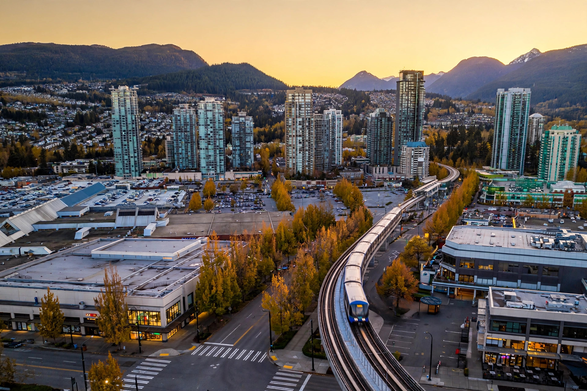
Coquitlam is the largest of the Tri-Cities, in the northeast corner of Metro Vancouver where the Fraser and Pitt Rivers meet the Coast Mountains. It is home to 148,625 people (2021 Census) spread across about 122 square kilometres - and it manages to feel like several cities in one: a tower-lined, SkyTrain-served City Centre in the middle, established family neighbourhoods to the south and west, golf-course streets on Westwood Plateau, and brand-new master-planned blocks climbing Burke Mountain in the northeast.
The name comes from the Kwikwetlem word for "red fish up the river," a nod to the sockeye salmon that once ran thick in the Coquitlam River. Lumber built the early city - Maillardville began as a Fraser Mills company town in 1909 - and the modern growth story is transit: the Evergreen Extension of the SkyTrain arrived in 2016 and turned Coquitlam Centre into one of the region's fastest-growing downtowns. What has not changed is the setting. Mountains, two rivers, and some of the biggest urban parks in Metro Vancouver are never more than a few minutes away.
Coquitlam Centre / City Centre - The city's downtown and its growth engine. Coquitlam Centre mall, the towers along Pinetree Way, Town Centre Park, Lafarge Lake, and three SkyTrain stations (Coquitlam Central, Lincoln, Lafarge Lake-Douglas) are all here, along with Douglas College's David Lam Campus and the Evergreen Cultural Centre. Condos and townhomes dominate - this is the first-time-buyer and investor entry point to the city.
Burke Mountain - Coquitlam's newest community, a master-planned mountainside in the northeast that is still being built out. Newer detached homes, townhomes, and low-rise condos climb streets that back onto forest and trail networks, with Burke Mountain Village as its emerging commercial heart. Popular with move-up families who want a new build without leaving the Tri-Cities.
Westwood Plateau - The prestige address, built around the Westwood Plateau Golf and Country Club on the northwest heights. Larger homes, mountain and valley views, quiet cul-de-sacs, and trailheads into the Burke Mountain wilderness at the top of the hill. Executive living, ten minutes above the City Centre.
Austin Heights - An established, walkable pocket along Austin Avenue in the southwest: local shops and restaurants, older family homes on generous lots, and the Vancouver Golf Club at its edge. Blue Mountain Park and the trails of Mundy Park are close by. Character and convenience without the City Centre price tag.
Como Lake Village - A village-style centre at Como Lake Avenue and Clarke Road, serving the established family streets around Como Lake Park. The lake itself has a fishing dock, playground, and a loop trail; the surrounding homes are mostly solid post-war and updated family houses. Dr. Charles Best Secondary is right in the neighbourhood.
Ranch Park - A quiet, established residential pocket wrapped around Ranch Park Elementary and the Vancouver Golf Club fairways. Ranchers and family homes on flat, tree-lined streets, with Mundy Park's 400 acres of forest trails at the western edge. A long-time local favourite that rarely turns over.
Maillardville - Coquitlam's heritage heart, founded in 1909 as a Fraser Mills company town and still the oldest Francophone community in BC. Heritage homes, Mackin Park, the Place des Arts, and the annual Festival du Bois give it a flavour no other Tri-Cities neighbourhood matches. Brunette Avenue retail and quick Highway 1 access keep it practical, too.
Coquitlam is served by School District 43 (Coquitlam) - one of the largest districts in BC, covering Coquitlam, Port Coquitlam, Port Moody, Anmore, and Belcarra. Secondary schools in the city include Pinetree Secondary (beside Town Centre Park), Dr. Charles Best Secondary (in the Como Lake area), Centennial Secondary, and Gleneagle Secondary, with dozens of elementary schools spread across every neighbourhood, including Smiling Creek Elementary on Burke Mountain. Douglas College's David Lam Campus sits in the City Centre, and Simon Fraser University is a short drive or SkyTrain ride west in Burnaby.
Coquitlam is one of the best-connected suburbs east of Vancouver. The Evergreen Extension of the Millennium Line runs four stations through the city - Burquitlam, Coquitlam Central, Lincoln, and Lafarge Lake-Douglas - putting downtown Vancouver roughly 45 minutes away by SkyTrain. The West Coast Express also stops at Coquitlam Central, reaching Waterfront Station in about 35 minutes on weekday peak trains. Drivers get Highway 1 across the Port Mann Bridge to Burnaby and Vancouver, Lougheed Highway running east-west through the Tri-Cities, and the Barnet Highway into Burnaby.
Green space is the headline. Mundy Park offers roughly 400 acres of coastal rainforest trails in the middle of the city, Town Centre Park hosts major sports tournaments and the free winter Lights at Lafarge display around Lafarge Lake, and Como Lake Park and Minnekhada Regional Park cover the quieter corners. Colony Farm Regional Park, co-managed with the Kwikwetlem First Nation, is one of the region's best birding spots.
Day-to-day, Coquitlam Centre and the Pinetree corridor handle shopping, the City Centre Aquatic Complex and Poirier Sport and Leisure Complex handle recreation, and the Evergreen Cultural Centre and Place des Arts handle theatre and arts. The Coquitlam Farmers Market runs Sundays at the Dogwood Pavilion, and Maillardville's Festival du Bois fills Mackin Park every spring.
Coquitlam is covered by Greater Vancouver REALTORS rather than the Fraser Valley board, so its numbers come from the Metro Vancouver report - a slower, buyer-leaning market this fall. Metro Vancouver recorded 1,717 sales in September 2026, down 8.4% from a year ago, with 16,394 active listings and a composite benchmark of $1,075,900, down 5.5% year over year. Coquitlam itself stayed comparatively busy: 141 sales and 515 new listings in September. The city's composite benchmark sits at $971,700 (down 6.3% year over year), with September 2026 benchmark prices of $1,584,400 for a detached home (down 6.6%), $976,600 for a townhouse (down 6.5%), and $640,100 for an apartment (down 7.3%). The story for buyers: SkyTrain-corridor condos and townhomes in the City Centre and Burquitlam offer some of the best transit value in Metro Vancouver right now. (Source: Greater Vancouver REALTORS, September 2026)
Is Coquitlam part of the Fraser Valley?
No - Coquitlam is a Metro Vancouver city in the Tri-Cities, and its real estate board is Greater Vancouver REALTORS, not the Fraser Valley board. Rohit helps buyers and sellers on both sides of that line.
How long is the commute from Coquitlam to downtown Vancouver?
About 45 minutes by SkyTrain on the Millennium Line (Evergreen Extension), or roughly 35 minutes on the West Coast Express from Coquitlam Central. Driving on Highway 1 varies with Port Mann Bridge traffic.
Which Coquitlam neighbourhood is best for families?
Burke Mountain and Westwood Plateau are the move-up picks for newer and larger homes; Como Lake Village, Austin Heights, and Ranch Park are the established, more affordable family pockets closer to the centre.
Is Coquitlam more affordable than Burnaby or Vancouver?
Generally, yes - the detached benchmark of about $1.58 million (September 2026) sits well below Vancouver and much of Burnaby, and City Centre apartments start lower still, with SkyTrain access included.
What is the Tri-Cities?
Coquitlam, Port Coquitlam, and Port Moody, plus the villages of Anmore and Belcarra - a group of communities in northeast Metro Vancouver that share School District 43 and the Evergreen Line.
Questions about a specific Coquitlam neighbourhood — or thinking of buying or selling here? Get in touch.
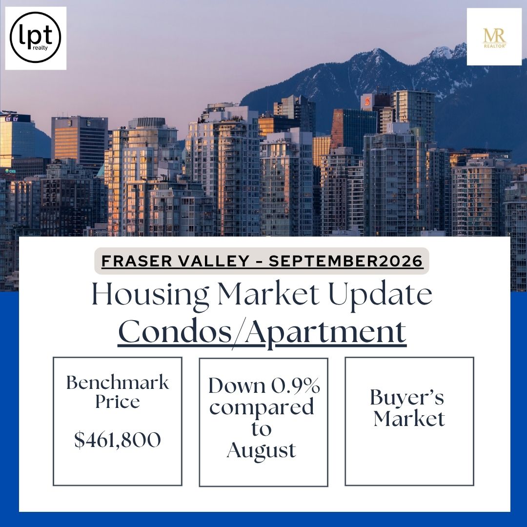
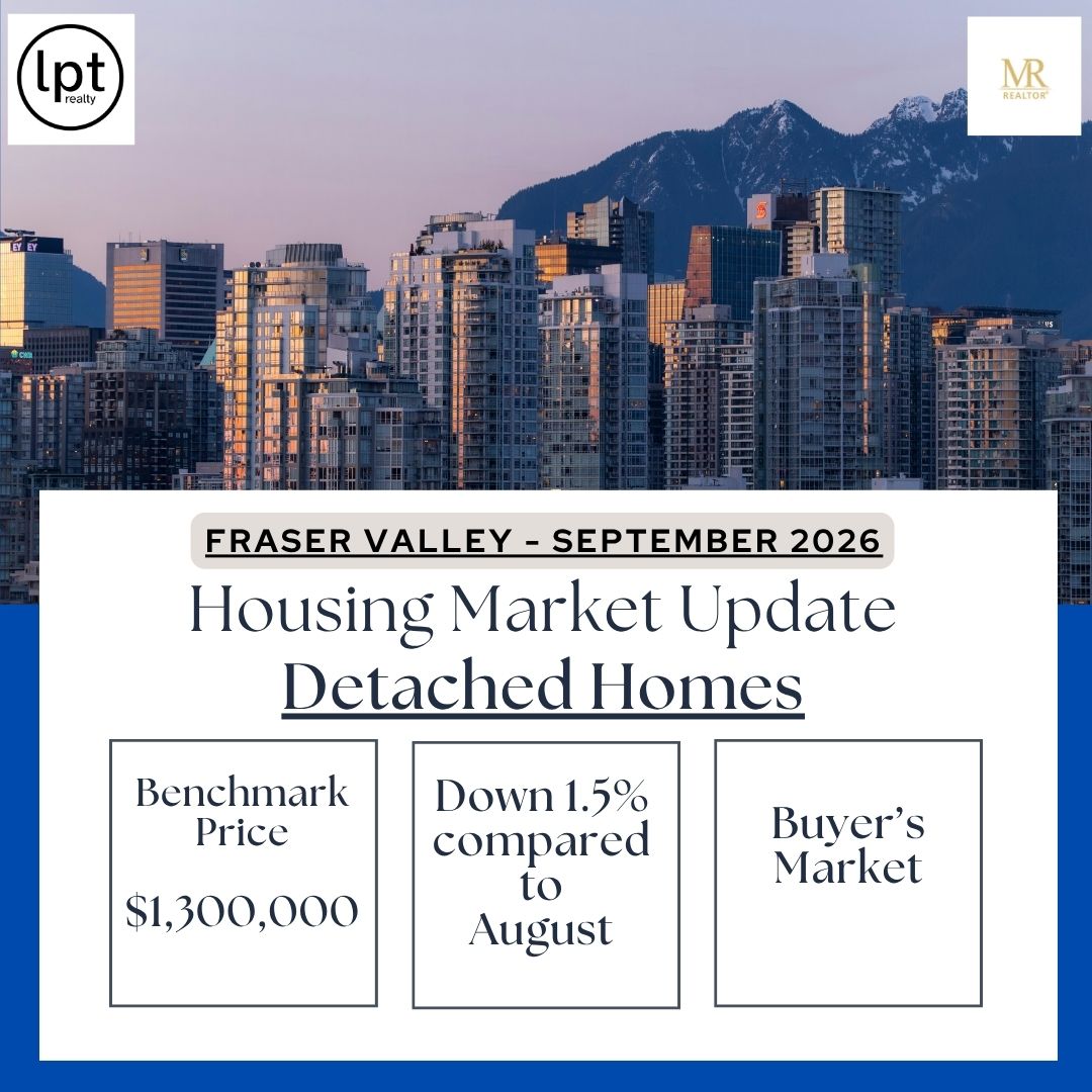
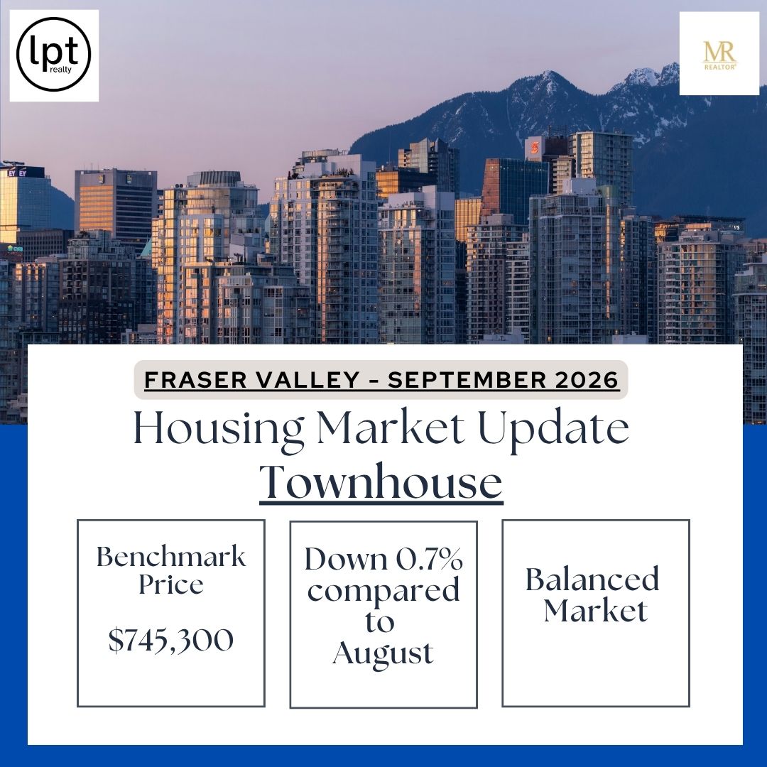
As of fall 2026, the Fraser Valley is firmly a buyer's market. September saw 922 sales across the region with a sales-to-active-listings ratio of just 9%, and the benchmark price is down about 7% from a year ago. Active listings are 31% above the ten-year average, which means buyers have real choice and room to negotiate.
(Source: FVREB, September 2026)
Across British Columbia, 5,254 homes sold in September 2026, down 8.9% from a year ago, with the average MLS price at $924,279 (down 2.4%). Sales ran 25.8% below the ten-year September average, but inventory has been easing month over month, keeping most BC markets balanced.
(Source: BCREA, September 2026)
Copyright British Columbia Real Estate Association. Reprinted with permission.
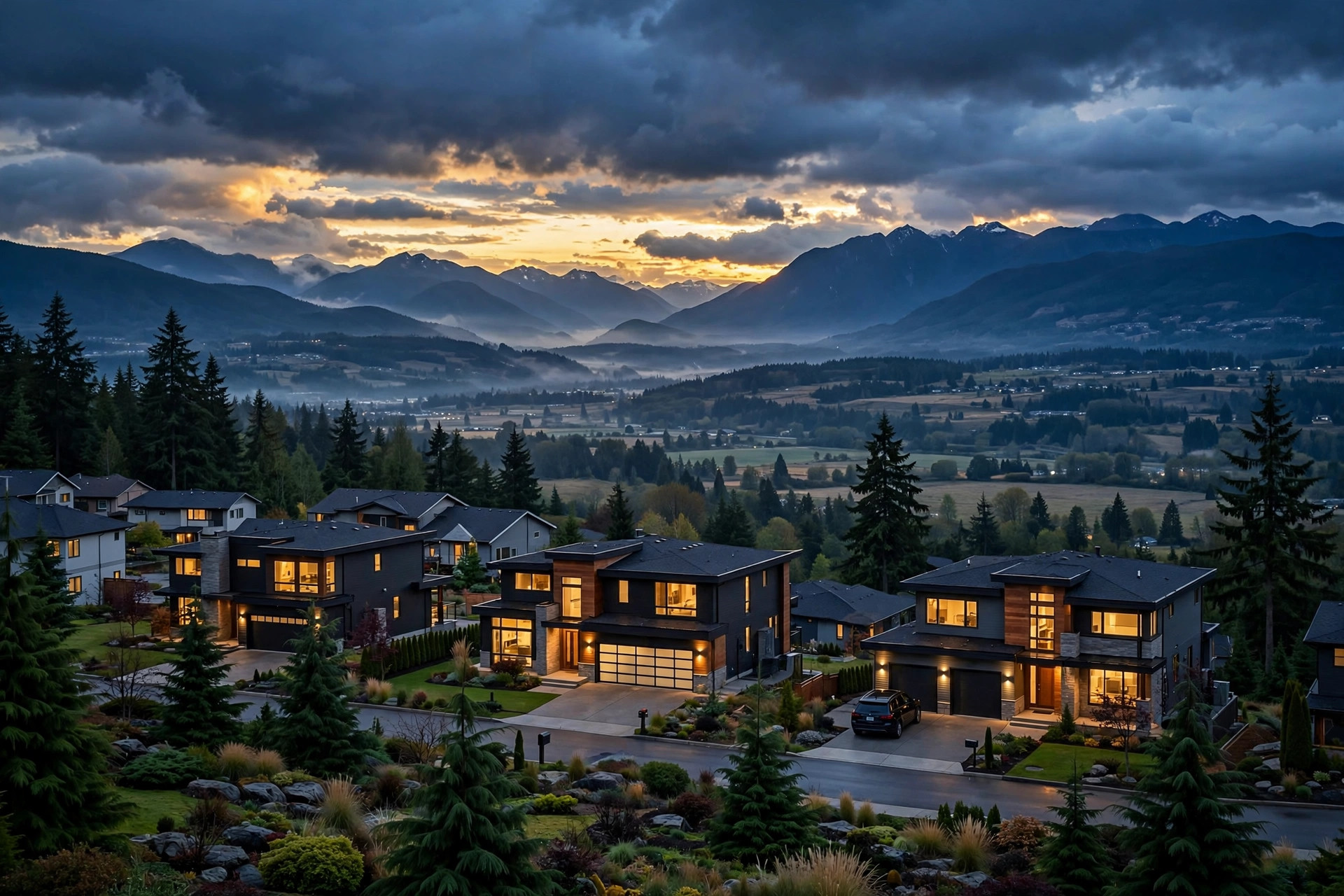
Langley sits about 45 kilometres east of Vancouver, at the western edge of the Fraser Valley — close enough to the city for work, far enough for space, quieter streets, and a backyard. It's actually two municipalities side by side: the Township of Langley (population ~132,600) and the City of Langley (~29,000), together home to more than 160,000 people and growing fast.
The area's history runs deep — Fort Langley, founded in 1827, is known as the birthplace of British Columbia, and the Township itself was incorporated in 1873. Today it's a mix of historic villages, master-planned new communities, and working farmland (about three-quarters of the Township sits in the Agricultural Land Reserve).
Willoughby — Langley's growth engine. What was farmland a generation ago is now a master-planned community heading toward 80,000+ residents at full build-out. The Latimer and Yorkson Creek areas have the newest housing stock — townhomes and condos that draw young families and commuters. R.E. Mountain Secondary and several new elementary schools serve the area, and Willoughby Town Centre is becoming a commercial hub of its own.
Walnut Grove — Established, green, and family-focused, tucked against Highway 1 in the northwest. Mature streets, good parks, and some of the area's most settled neighbourhoods. A natural pick for commuters who want to be near the highway.
Fort Langley — The historic village, with 150+ years of stories in its heritage buildings and the Fort Langley National Historic Site. Antique shops, cafés, and riverfront walks give it a small-town feel unlike anywhere else in Metro Vancouver. Charming — and priced like it.
Murrayville — One of Langley's oldest communities, calm and walkable, with historic schools, churches, and landmarks mixed into quiet residential streets.
Brookswood — For buyers who want room to breathe: larger lots, a semi-rural feel, and a strong community core with a civic centre, hockey and curling rinks, and a skate park.
Aldergrove — Country living on the Township's eastern edge, surrounded by farms. Home to the Greater Vancouver Zoo, a well-used community centre with a waterpark and arena, and the Aldergrove border crossing into the US.
Langley City — The urban heart: walkable downtown streets with independent shops and restaurants, plus condos and apartments that make it one of the more affordable entries into the area. It's also where the future SkyTrain line will end.
Langley is served by School District 35, with elementary and secondary schools across every community listed above — including newer schools in the fast-growing Willoughby area. For post-secondary, Trinity Western University and a Kwantlen Polytechnic University campus are both located in the Township.
Most Langley commuters drive Highway 1 — roughly 45 minutes to an hour into Vancouver outside peak times. The Golden Ears Bridge connects across the river to Maple Ridge and Pitt Meadows.
The big change coming is rapid transit: the Surrey–Langley SkyTrain (Dave Barrett Extension) is under construction now, with service expected to begin in late 2029. The 16-kilometre, eight-station extension will run from King George Station in Surrey to Langley City Centre — a 22-minute ride between the two, and a little over an hour from Langley City Centre to downtown Vancouver.
There's plenty that keeps people local on weekends: the Langley Events Centre hosts the WHL's Vancouver Giants and the CEBL's Vancouver Bandits, Vancouver FC plays at Willoughby Community Park Stadium, and the area has wineries, golf courses, and trail networks throughout. Fort Langley's village shops and the riverfront are a standing weekend outing for the whole region.
As of fall 2026, the Fraser Valley is firmly a buyer's market. September saw 922 sales across the region with a sales-to-active-listings ratio of just 9%, and the benchmark price is down about 7% from a year ago — single-family homes sit roughly $460,000 below the March 2022 peak. Active listings are 31% above the ten-year average, which means buyers have real choice and room to negotiate. (See the Stats Centre for the latest monthly numbers.) (Source: FVREB, September 2026)
Is Langley a good place to live?
For families and anyone trading a Vancouver condo for space, yes — good schools, parks in every direction, and a genuine community feel in each village and neighbourhood.
How long is the commute from Langley to Vancouver?
About 45–60 minutes by car on Highway 1 outside rush hour. The SkyTrain extension arriving in late 2029 will add a rail option: Langley City Centre to downtown Vancouver in a little over an hour.
Which Langley neighbourhood is best for families?
Willoughby and Walnut Grove are the most popular picks — newer schools, parks, and family-sized townhomes. Brookswood suits families wanting bigger lots; Fort Langley suits those who value character over square footage.
Is Langley more affordable than Vancouver?
Generally, yes — particularly for detached homes and townhomes, which is exactly why so many buyers move east along the Fraser Valley. In the current buyer's market, there's also more room to negotiate than there has been in years.
When is the SkyTrain coming to Langley?
The Surrey–Langley SkyTrain extension is under construction with service expected in late 2029. Eight stations will run from King George Station in Surrey to Langley City Centre.
Questions about a specific Langley neighbourhood — or thinking of buying or selling here? Get in touch.
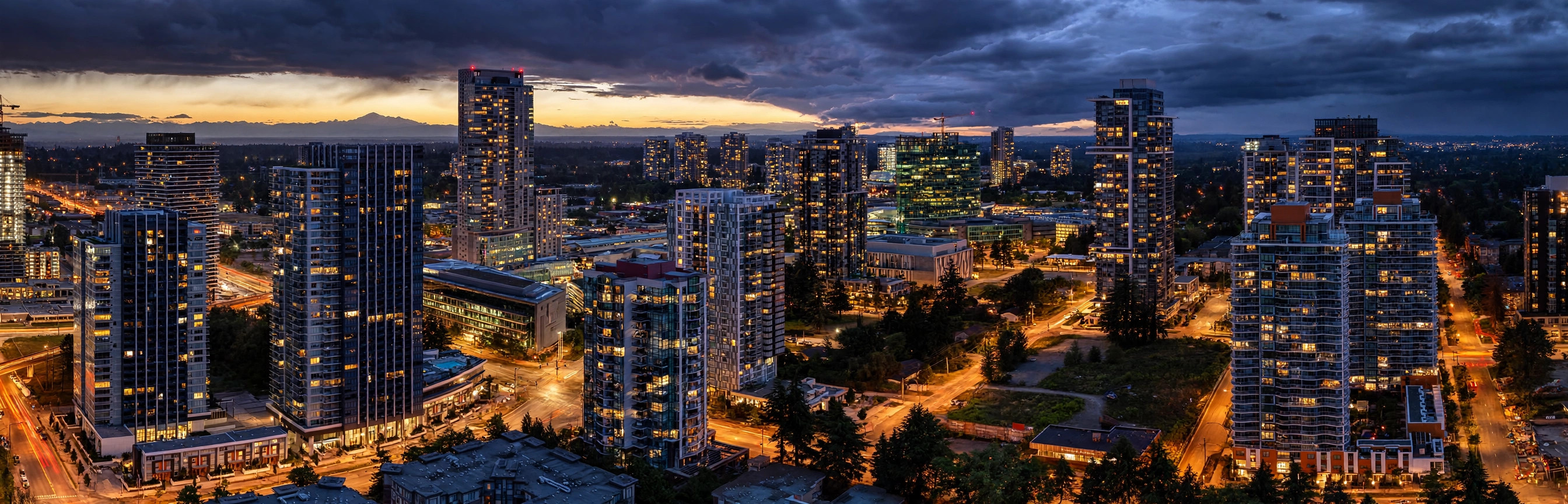
Surrey is British Columbia's fastest-growing metropolis, home to over 600,000 residents and projected to overtake Vancouver as the province's largest city before the decade is out. Stretching from the Fraser River south to the United States border, Surrey offers an unprecedented diversity of lifestyles — from sleek urban high-rises in City Centre to sprawling equestrian estates in South Surrey.
Incorporated in 1879, Surrey is uniquely defined by its six distinct town centres: City Centre (Whalley), Guildford, Fleetwood, Cloverdale, Newton, and South Surrey. Known as the "City of Parks," Surrey balances ambitious urban modernization with more than 6,000 acres of protected green space, urban forests, and coastline.
City Centre (Whalley) — Surrey's metropolitan downtown core. Anchored by the Surrey Central and King George SkyTrain hubs, SFU's landmark campus, and modern civic plazas, City Centre is an epicenter of high-rise luxury towers, tech innovation, and rapid transit access to downtown Vancouver.
South Surrey & Morgan Creek — Surrey's premier luxury and seaside enclave. Bordering White Rock, South Surrey features prestigious golf-course master communities like Morgan Creek, upscale open-air shopping at The Shops at Morgan Crossing, and quick access to Crescent Beach and the US border.
Fleetwood — A quiet, verdant residential favorite for families. Known for large suburban lots, tree-lined cul-de-sacs, and community recreation centres. With four new stations under construction along the Surrey–Langley SkyTrain line, Fleetwood is also one of the region's strongest transit-corridor growth investments.
Cloverdale & Clayton — A rich blend of heritage and master-planned growth. The historic town centre hosts the world-famous Cloverdale Rodeo and village antique shops, while Clayton Heights offers walkable contemporary townhomes, parks, and schools favored by first-time buyers and young families.
Guildford — A well-established commercial and residential hub in the northeast. Centered around Guildford Town Centre (one of BC's largest shopping destinations) with immediate access to Highway 1 and the Port Mann Bridge, as well as the sprawling nature trails of Tynehead Regional Park.
Newton — A vibrant, culturally diverse powerhouse with a strong community pulse. Features established single-family homes, the Bell Performing Arts Centre, extensive community sports arenas, and convenient transit corridors.
Surrey is served by School District 36 — the largest public school district in British Columbia — operating over 130 elementary and secondary schools, including French Immersion, Montessori, and Traditional school options. For higher education, Simon Fraser University (SFU Surrey) anchors City Centre with its state-of-the-art Sustainable Energy Engineering facility, and Kwantlen Polytechnic University (KPU) maintains major campuses in Newton and Cloverdale.
Transit connectivity is Surrey's standout advantage. The Expo Line SkyTrain delivers a seamless ~35-to-40 minute direct connection from Surrey Central and King George stations directly to downtown Vancouver without touching highway traffic.
The landmark Surrey–Langley SkyTrain Extension is actively underway: a 16-kilometre elevated extension adding 8 new stations along Fraser Highway through Fleetwood and Clayton into Langley City Centre, with passenger service scheduled for 2029.
For motorists, Highway 1 and the Port Mann Bridge link north Surrey to Burnaby and Vancouver, Highway 99 connects South Surrey to Richmond and YVR, Highway 17 provides express riverfront connectivity, and two international crossings (Peace Arch and Pacific Highway) put Washington State minutes away.
Surrey's "City of Parks" reputation is well earned. Green Timbers Urban Forest offers 500+ acres of nature trails and fishing lakes in the heart of the city, while Bear Creek Park, Tynehead Regional Park, and the scenic beaches of Crescent Beach provide endless weekend escapes.
Culturally, Surrey hosts major signature festivals including the internationally recognized Surrey Fusion Festival, Canada Day at the Bill Reid Millennium Amphitheatre, and world-class athletic facilities like the Surrey Sport & Leisure Complex and South Surrey Athletic Park.
As of fall 2026, the Fraser Valley is firmly a buyer's market. September saw 922 sales across the region with a sales-to-active-listings ratio of just 9%, and the benchmark price is down about 7% from a year ago — single-family homes sit roughly $460,000 below the March 2022 peak. Active listings are 31% above the ten-year average, which means buyers have real choice and room to negotiate. (See the Stats Centre for the latest monthly numbers.) (Source: FVREB, September 2026)
Is Surrey a good place to live?
Absolutely. Surrey combines big-city economic opportunity, world-class rapid transit, and extensive parkland with substantially more housing variety and value than Vancouver or Burnaby.
How long is the commute from Surrey to downtown Vancouver?
Via the Expo Line SkyTrain, approximately 35–40 minutes from Surrey Central or King George. Driving via Highway 1 or Highway 99 takes 35–50 minutes outside rush hour.
Which Surrey neighbourhood is best for families?
Fleetwood, Clayton Heights, and South Surrey (Morgan Creek / Grandview) are perennial family favorites for their top-rated schools, walkable community parks, and quiet residential streets.
Is Surrey more affordable than Vancouver?
Yes — buyers consistently gain more square footage, newer construction, and larger lot sizes compared to Vancouver, making it the primary relocation choice for growing families and astute investors.
When is the Surrey–Langley SkyTrain extension opening?
Construction is actively progressing, with the 16-kilometre extension and 8 new stations along Fraser Highway anticipated to open for passenger service in late 2029.
Questions about a specific Surrey neighbourhood — or thinking of buying or selling here? Get in touch.
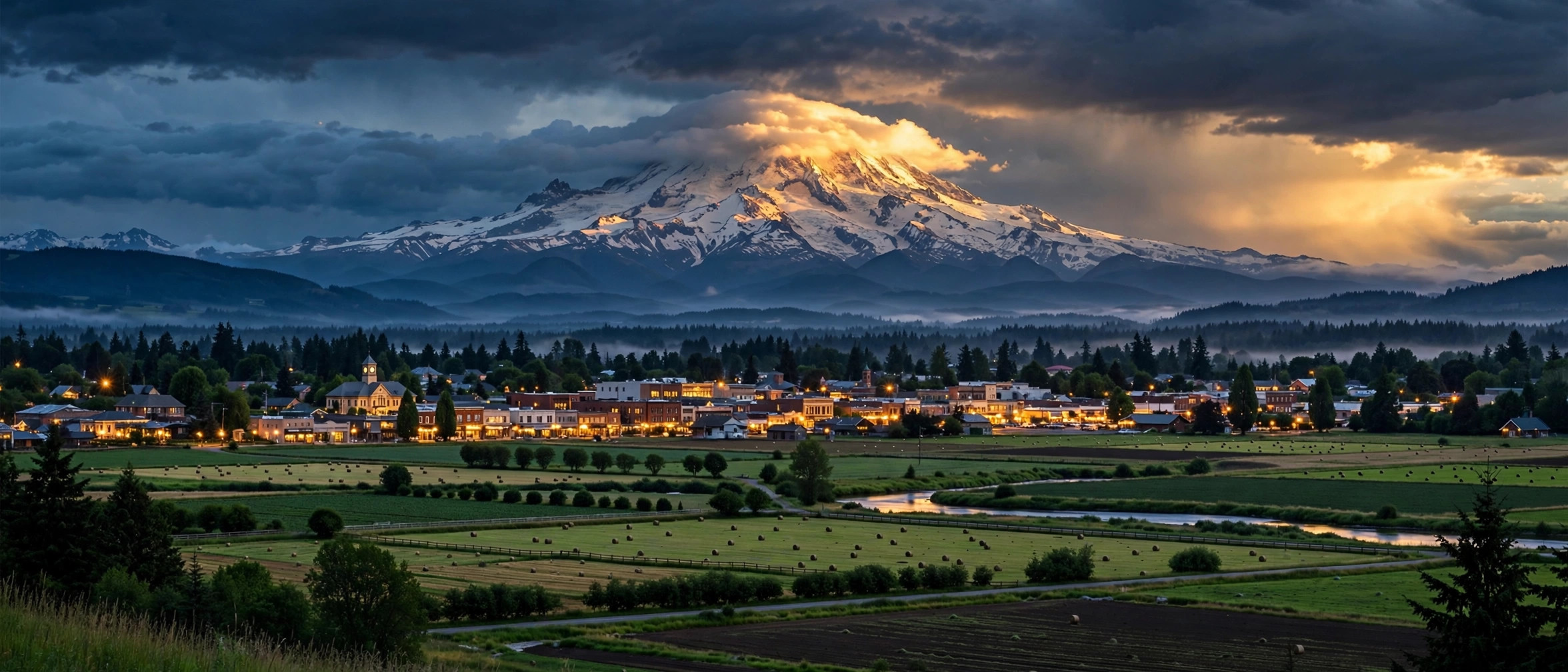
Abbotsford sits about 70 kilometres east of Vancouver, in the heart of the Fraser Valley — the region's largest city, with more than 153,000 residents at the 2021 Census, and the largest municipality by land area in the Lower Mainland. Formed in 1995 when the District of Matsqui and the District of Abbotsford amalgamated, it still wears both identities: a real working farm economy on the prairies, and a fast-growing urban centre around the city core.
It's also one of the most diverse cities in the country — more than 50 languages are spoken here, and Punjabi is the mother tongue of over a fifth of residents. That shows up everywhere: in the food, the festivals, and the farmland, where many of the valley's biggest agricultural operations are family-run.
Clearbrook — Abbotsford's commercial core. Sevenoaks Shopping Centre, the hospital, and much of the city's condo and townhome stock sit here. Diverse, busy, and the most urban-feeling part of the city — a natural pick for first-time buyers and investors.
Historic Downtown / West Abbotsford — The older city west of the core, centred on Mill Lake Park. Established streets, heritage character, and the lake's walking trails as a daily backdrop. The downtown core here is in the middle of ongoing redevelopment.
Auguston — A master-planned family community on the slopes of Sumas Mountain in east Abbotsford. Parks, trails, and newer single-family homes built around a village-style centre — one of the most popular picks for young families.
Sumas Mountain — The eastern highlands: acreages, estate homes, and some of the best views in the Fraser Valley. Eagle Mountain offers a more manicured estate feel; the wider mountain area brings hiking and mountain-biking trails to your doorstep.
Matsqui Prairie / Bradner–Mt. Lehman — The rural west and north: working farmland, multi-acre parcels, and a deep agricultural heritage. For buyers who want real privacy, hobby farms, or long-term land holds.
Sandy Hill — A quiet, family-oriented pocket known for its concentration of cul-de-sacs — little through-traffic, lots of kids outside. Solid mid-range detached homes close to everyday amenities.
UDistrict — The neighbourhood around the University of the Fraser Valley's main campus. Younger, denser, and rental-friendly — appealing to students, staff, and investors alike.
Abbotsford is served by School District 34 (Abbotsford), with elementary, middle, and secondary schools across every neighbourhood listed above. For post-secondary, the University of the Fraser Valley's main campus is right here in Abbotsford — the largest of its campuses — so students can study close to home.
Most Abbotsford commuters take Highway 1 west — about an hour into Vancouver outside peak times. Highway 11 connects north to Mission and south to the Sumas border crossing into the US, which matters for cross-border shoppers and travellers.
The other commute story is the airport: Abbotsford International Airport (YXX) offers domestic flights and is far easier to get in and out of than YVR for valley residents — a genuine lifestyle factor for frequent flyers.
Mill Lake Park is the city's backyard — walking trails, beaches, and picnic spots minutes from downtown. Fishtrap Creek and the Matsqui Trail along the Fraser River cover the nature side, while Clayburn Village (BC's first company town, now a heritage conservation area) is the history fix.
For entertainment: the Abbotsford Centre hosts the AHL's Abbotsford Canucks, Tradex draws regional events and trade shows, Castle Fun Park covers family outings, and the annual Agrifair celebrates the farm economy the city is built on.
As of fall 2026, the Fraser Valley is firmly a buyer's market. September saw 922 sales across the region with a sales-to-active-listings ratio of just 9%, and the benchmark price is down about 7% from a year ago — single-family homes sit roughly $460,000 below the March 2022 peak. Active listings are 31% above the ten-year average, which means buyers have real choice and room to negotiate. (See the Stats Centre for the latest monthly numbers.) (Source: FVREB, September 2026)
Is Abbotsford a good place to live?
For buyers who want space, yes — larger lots than anything west of here, a genuinely diverse community, and every kind of housing from downtown condos to mountain acreages. The trade-off is distance from Vancouver.
How long is the commute from Abbotsford to Vancouver?
About an hour by car on Highway 1 outside rush hour — longer at peak. Many residents work locally or in Langley/Surrey instead, and the airport makes travel days easier than in most suburbs.
Which Abbotsford neighbourhood is best for families?
Auguston and Sandy Hill are the classic family picks — parks, trails, and quiet streets. Matsqui Prairie and Bradner suit families wanting acreage; Clearbrook works for families who'd trade the yard for walkability.
Is Abbotsford more affordable than Vancouver?
Generally, yes — significantly, especially for detached homes and townhomes. That gap is the main reason buyers keep moving east up the valley. In the current buyer's market, there's also more room to negotiate than there has been in years.
What's the deal with the airport and the US border?
Abbotsford International Airport (YXX) handles domestic flights with far less hassle than YVR. And the Sumas border crossing at the south end of Highway 11 puts Washington State — and cheaper cross-border shopping — minutes away.
Questions about a specific Abbotsford neighbourhood — or thinking of buying or selling here? Get in touch.
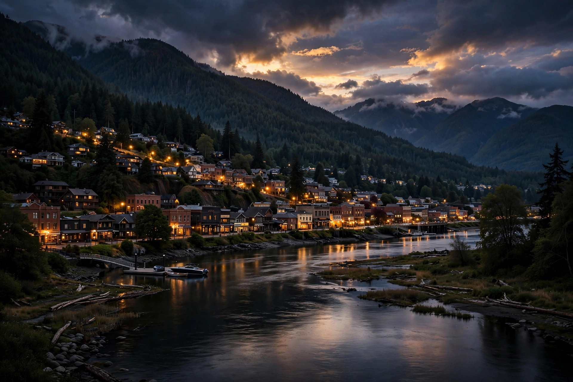
Mission sits on the north bank of the Fraser River, about 65 kilometres southeast of Vancouver, with the mountains and lakes of the Central Fraser Valley rising behind it. Incorporated as a district municipality in 1892, it officially became a city in March 2021, and the 2021 Census counted 41,519 residents. Unlike its flatter valley neighbours, Mission is mostly forested upland — farmland benches rise north of the town core, and the river defines its southern edge.
The town's roots are in farming and forestry — it was once the heart of the valley's berry industry and its mills were among the world's largest producers of red cedar shakes. Today it draws buyers who want space, nature access, and a quieter pace, with Abbotsford just across the Mission Bridge and Maple Ridge a short drive west.
Mission City / Downtown — The historic core along the river, with the West Coast Express station, shops, and services. The most urban part of Mission and the natural base for rail commuters.
Hatzic — East of downtown: suburban streets and rural properties near Hatzic Lake. Family-oriented, with room to spread out.
Ferndale — Central Mission's rural heartland: acreages, farms, and quiet country roads, minutes from town amenities.
Silverdale — West along the Stave River, homesteaded in the 1880s by Italian immigrants whose descendants still live here. New hillside development is gradually adding homes.
Stave Falls — North toward the lakes: forested, quiet, and close to Hayward and Stave Lake recreation. Buyers here trade convenience for trees and water.
Steelhead — Rural and rugged in the northern hills, popular with buyers who want privacy, larger lots, and direct trail access.
Cedar Valley — A farming community in the valley's northern reaches — country living with mountain views, still within the district.
Mission is served by School District 75 (Mission Public Schools) — about 16 schools and roughly 6,500 students. Mission Secondary and Heritage Park Middle School anchor the secondary years, with neighbourhood elementary schools like Hatzic, Silverdale Creek, and Cherry Hill spread across the community. For post-secondary, the University of the Fraser Valley's Mission campus sits at Heritage Park Centre on the hillside — fully renovated and reopened in 2024 as the home of UFV's School of Education.
Highway 7 (the Lougheed Highway) is Mission's main artery — west to Maple Ridge and on toward Vancouver, east to Agassiz and Harrison. The Mission Bridge (Highway 11) crosses the Fraser to Abbotsford and Highway 1, putting Abbotsford about 20 minutes away and Maple Ridge about 15.
Mission's standout commuting option is rail: Mission City station is the eastern terminus of the West Coast Express, with five morning trains to Waterfront Station in downtown Vancouver (about 75 minutes) and five afternoon returns, weekdays. Driving to downtown Vancouver via Highway 7 typically runs 60–90 minutes depending on traffic.
The Fraser River is Mission's front yard — waterfront parks, dikes for walking and cycling, and Fraser River Heritage Park overlooking the water. The hilltop Westminster Abbey offers one of the valley's best viewpoints. Mission Raceway Park hosts drag racing through the season, the Mission City Outlaws play junior hockey, and Stave Lake, Hayward Lake, and Rolley Lake put boating, fishing, and swimming within easy reach.
For entertainment: the Abbotsford Centre hosts the AHL's Abbotsford Canucks, Tradex draws regional events and trade shows, Castle Fun Park covers family outings, and the annual Agrifair celebrates the farm economy the city is built on.
As of fall 2026, the Fraser Valley is firmly a buyer's market. September saw 922 sales across the region with a sales-to-active-listings ratio of just 9%, and the benchmark price is down about 7% from a year ago — single-family homes sit roughly $460,000 below the March 2022 peak. Active listings are 31% above the ten-year average, which means buyers have real choice and room to negotiate. (See the Stats Centre for the latest monthly numbers.) (Source: FVREB, September 2026)
Is Mission a good place to live?
If you want space and nature over urban buzz, yes — larger lots, lake and trail access, and a genuine small-city feel, with Abbotsford and Maple Ridge close for anything Mission doesn't have.
How long is the commute from Mission to Vancouver?
The West Coast Express takes about 75 minutes from Mission City station to Waterfront, weekdays. Driving via Highway 7 is typically 60–90 minutes depending on traffic.
Is Mission more affordable than Abbotsford?
Generally, yes — particularly for detached homes with land. Many families find they get more house for their money in Mission, trading some shopping variety and highway convenience for space.
What is there to do in Mission?
Boating and fishing on Stave and Hayward Lakes, hiking and biking on forest trails, drag racing at Mission Raceway Park, junior hockey, riverfront parks — plus the Westminster Abbey viewpoint and a historic downtown core.
Which school district serves Mission?
School District 75 (Mission Public Schools), with about 16 schools and roughly 6,500 students, plus the UFV Mission campus at Heritage Park Centre for post-secondary.
Questions about a specific Mission neighbourhood — or thinking of buying or selling here? Get in touch.
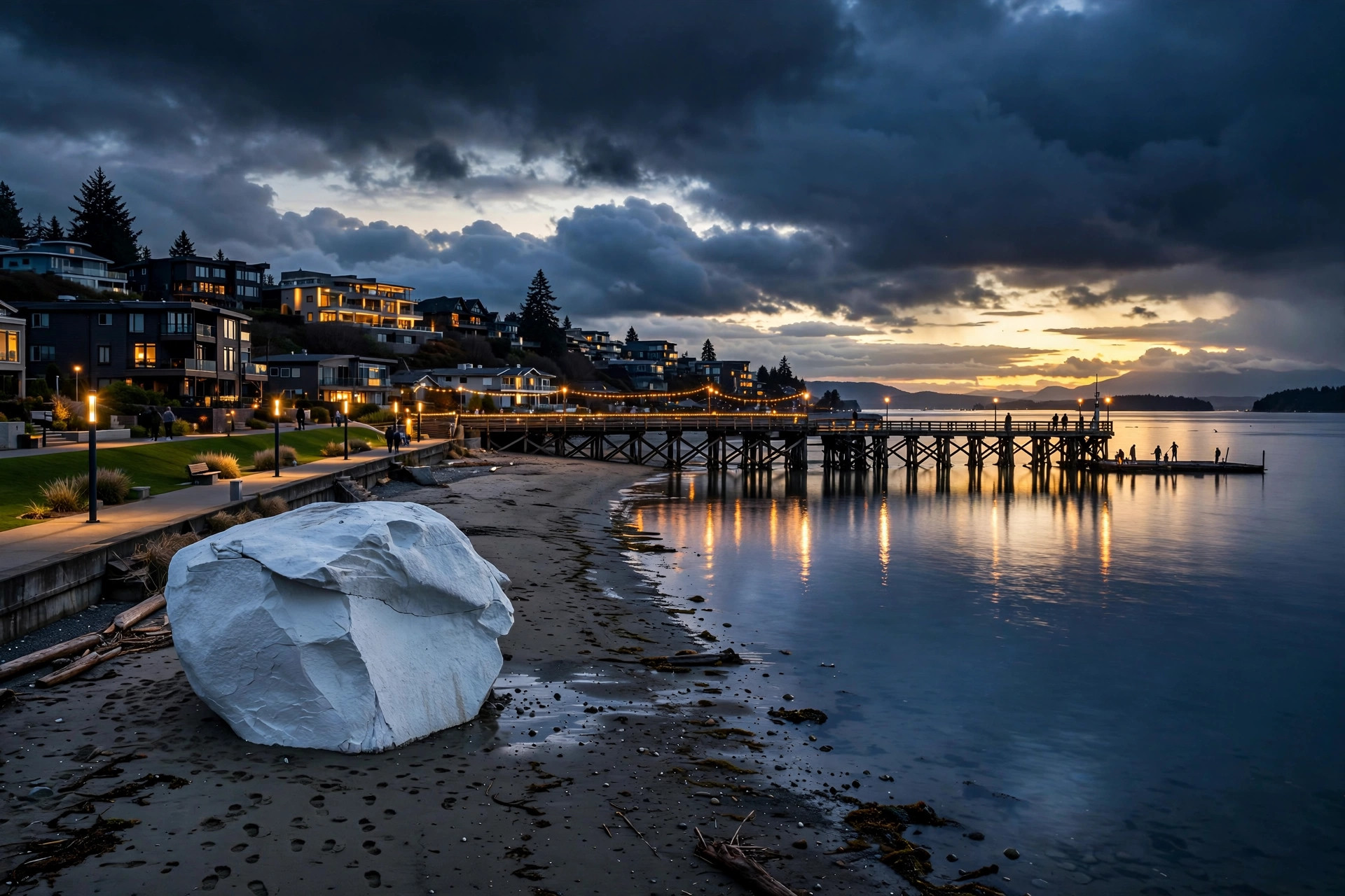
White Rock is a small seaside city on the shores of Semiahmoo Bay, about 45 kilometres south of Vancouver and minutes from the US border. Just 21,939 people called it home in the 2021 Census, packed into a land area of only 5.17 square kilometres — one of the most compact cities in the region. It became its own city on April 15, 1957, when residents chose to separate from the District of Surrey rather than be governed as its suburban appendage.
The city takes its name from the famous white boulder on the beach — a glacial erratic painted white, sitting near the waterfront promenade. White Rock skews older than the regional average (more than a third of residents are over 65), which gives it a relaxed, resort-town feel: walkable streets, patios on Marine Drive, and a waterfront that functions as the city's living room.
West Beach (Pier District) — The beating heart of White Rock. The 470-metre pier, the busiest stretch of the promenade, and Marine Drive's restaurants and cafés. A mix of historic cottages and modern condos, all angled toward the view of the bay. Steep streets, high energy in summer, and the priciest addresses in the city.
East Beach — Quieter than West Beach, separated from it by "the hump," the rise in the shoreline locals use as a landmark. Wide sandy stretches at low tide, picnic areas, and a family-first feel. Fewer dining options right on the sand, more room to breathe.
Five Corners — A funky, village-like pocket a few blocks up from the water, where five streets meet. Heritage homes, boutique condo buildings, and bungalows with character — the kind of place where people renovate an older home rather than tear it down. Galleries and the local theatre give it an artsy edge.
Uptown White Rock — The city's commercial hub, built around Johnston Road: shops, clinics, the library, the Sunday farmers' market, and Peace Arch Hospital nearby. Mostly condos and townhomes — the practical, walkable choice for downsizers and young professionals who want everything close.
Upper White Rock — The bluff-top residential streets above Marine Drive. Established single-family homes, many with ocean views over the bay, tucked into quiet streets a short walk or drive from the waterfront.
White Rock is served by School District 36, the largest school district in British Columbia, which covers both Surrey and White Rock. In the city itself: White Rock Elementary and Peace Arch Elementary (which offers French Immersion). For secondary school, students attend Semiahmoo Secondary (founded 1940, an IB World School) or Earl Marriott Secondary in nearby South Surrey. Post-secondary students head to Kwantlen Polytechnic University or Simon Fraser University's Surrey campus, both a short drive away.
White Rock is a driving city. Highway 99 runs north through Surrey and Richmond to Vancouver — the trip to downtown is about 45 kilometres and roughly 45–60 minutes by car outside peak times (allow more on sunny summer weekends, when beach traffic builds). There is no SkyTrain here; the Expo Line ends at King George in Surrey, and transit riders connect via the Canada Line to Bridgeport Station, then the 351 bus to White Rock Centre. One bonus of the location: the Peace Arch border crossing into the US is just minutes south.
Five kilometres of waterfront is the headline. The White Rock Pier — built in 1914 as a steamship wharf for the Great Northern Railway, at 470 metres the longest pier on Canada's Pacific coast — was battered by a December 2018 windstorm and rebuilt, reopening in 2019. The 2.19-kilometre promenade runs between the train tracks and the beach from West Beach to East Beach. Marine Drive is the dining strip: fish and chips, seafood patios, and gelato with a view of Mount Baker and the Gulf Islands.
Beyond the waterfront: the White Rock Museum & Archives in the 1913 railway station, the annual White Rock Sea Festival & Semiahmoo Days with its beachfront fireworks, Centennial Park's open fields, and the Kent Street Activity Centre's programs for older residents. Locals will tell you the city gets more sunshine than Vancouver — Environment Canada data backs them up.
As of fall 2026, the Fraser Valley is firmly a buyer's market. September saw 922 sales across the region with a sales-to-active-listings ratio of just 9%, and the benchmark price is down about 7% from a year ago — single-family homes sit roughly $460,000 below the March 2022 peak. Active listings are 31% above the ten-year average, which means buyers have real choice and room to negotiate. (See the Stats Centre for the latest monthly numbers.) (Source: FVREB, September 2026)
Is White Rock part of Surrey?
No — White Rock has been its own city since 1957, bordered by South Surrey on three sides and Semiahmoo Bay on the fourth. It does share School District 36 with Surrey, which is why the two are often mentioned together.
Is White Rock a good place to live?
If you want a walkable, resort-style beach town, yes. It's especially popular with retirees and downsizers — more than a third of residents are over 65 — but the waterfront lifestyle draws buyers of all ages.
How long is the commute from White Rock to Vancouver?
About 45–60 minutes by car on Highway 99 outside rush hour. Transit takes longer: Canada Line to Bridgeport, then the 351 bus to White Rock Centre.
Which White Rock neighbourhood is best for families?
East Beach is the classic family pick — quieter streets, sandy shore at low tide, picnic areas. Uptown works well for families who'd rather trade the backyard for walk-to-everything convenience.
Is White Rock more affordable than Vancouver?
Generally, yes — significantly, especially for condos and townhomes uptown. That said, anything with a water view commands a premium; beachfront White Rock is among the priciest real estate in the Fraser Valley.
Questions about a specific White Rock neighbourhood — or thinking of buying or selling here? Get in touch.
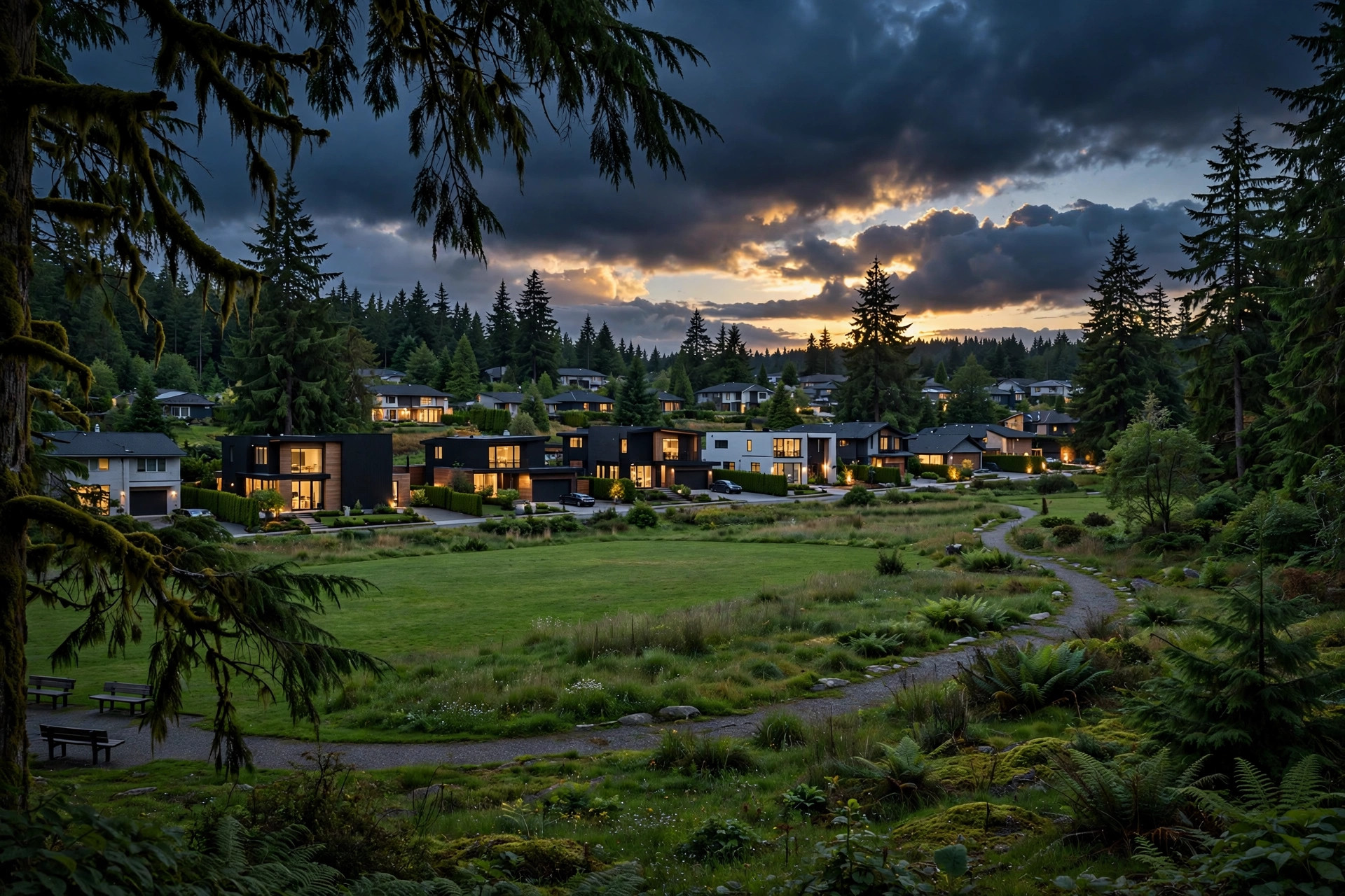
North Delta sits on the south bank of the Fraser River, directly across the water from New Westminster and a short drive from Surrey. It's one of three communities that make up the City of Delta — alongside Ladner and Tsawwassen — and the largest of the three, home to about 60,000 of Delta's 108,455 residents (2021 census).
The roots run deep: Annieville, on the riverfront, was the original settlement and the site of the first commercial salmon cannery in BC, back in 1870. The modern suburb took shape after the Alex Fraser Bridge opened in 1986, turning North Delta into one of the region's most practical commuter bases. Today it's overwhelmingly residential — quiet streets, established trees, and a family-first reputation with real value compared to Vancouver.
Sunshine Hills — The name buyers ask for first. Upscale, well-kept streets around Sunshine Hills Park, popular with families for the schools and parks. One of North Delta's most established and sought-after pockets.
Sunshine Woods — Just east of Sunshine Hills, similar family appeal with mature cedar trees and quieter cul-de-sacs. A natural alternative for buyers priced out of Sunshine Hills itself.
Scottsdale — North Delta's commercial and transit hub, centred on Scottsdale Centre and the busy Scott Road corridor. Condos, townhomes, and shops cluster here — the most urban-feeling part of North Delta and the easiest entry point.
Annieville — The historic riverside neighbourhood, with some of North Delta's oldest streets and larger, established lots. Heritage character with easy access to Highways 91 and 99.
Nordel — Central North Delta around Nordel Way: single-family streets, townhomes, and newer infill, handy to the Sungod Recreation Centre and quick routes to the Alex Fraser Bridge.
Sunbury — Tucked against the hillside in the southwest, with Sunbury Park and neighbourhood trails. Quieter, more tucked-away, with a strong community feel.
Canterbury Heights — Elevated streets in the west with some of North Delta's better valley views. Established, residential, and close to Watershed Park's trail network.
North Delta is served by School District 37 (Delta), with five secondary schools: North Delta Secondary, Seaquam Secondary, Sands Secondary, Burnsview, and Delview — plus elementary schools including Sunshine Hills, Cougar Canyon, Annieville, Gray, and Heath.
North Delta is built for commuters. Highway 91 runs through the community and crosses the Fraser River on the Alex Fraser Bridge toward New Westminster, with onward connections to Burnaby and Vancouver. Highway 99 via the George Massey Tunnel is the other main route — downtown Vancouver is roughly 30–45 minutes by car, depending on traffic. Highway 17 links east to Surrey and the port lands, and Surrey itself is only minutes away across the river. Buses along Scott Road connect to SkyTrain at Scott Road Station in Surrey.
Green space is North Delta's calling card. Watershed Park (11600 Kittson Parkway) is Delta's largest park — a forested trail network built around Cougar Creek, through Douglas fir, hemlock, and red cedar. It borders Burns Bog to the south, and together the two protected areas form one of the biggest continuous stretches of undeveloped land left in the region.
For organized recreation, the Sungod Recreation Centre (7815 112 Street) is the community hub: four pools, a swirl pool, sauna and steam room, weight room, aerobic studio, and an ice rink. The North Delta Recreation Centre adds another rink, curling sheets, and a seasonal outdoor pool. Day-to-day shopping centres on Scottsdale Centre, the Scott 72 Centre, and Delta Shoppers Mall.
As of fall 2026, the Fraser Valley is firmly a buyer's market. September saw 922 sales across the region with a sales-to-active-listings ratio of just 9%, and the benchmark price is down about 7% from a year ago — single-family homes sit roughly $460,000 below the March 2022 peak. Active listings are 31% above the ten-year average, which means buyers have real choice and room to negotiate. (See the Stats Centre for the latest monthly numbers.) (Source: FVREB, September 2026)
Is North Delta a good place to live?
For families, yes — one of the region's most consistent family picks. Good schools, big parks, quiet streets, and a reasonable commute to Vancouver, Surrey, and Richmond.
How long is the commute from North Delta to Vancouver?
Roughly 30–45 minutes by car, depending on traffic — Highway 91 over the Alex Fraser Bridge, or Highway 99 through the George Massey Tunnel. Buses along Scott Road connect to SkyTrain at Scott Road Station in Surrey.
Which North Delta neighbourhood is best for families?
Sunshine Hills and Sunshine Woods are the classic picks — established streets, good schools, and parks. Scottsdale suits buyers wanting condo or townhome convenience near shops and transit; Annieville appeals to those wanting larger lots.
Is North Delta more affordable than Vancouver?
Generally, yes — particularly for detached homes, which is why so many buyers cross the river from Vancouver and Burnaby. In the current buyer's market, there's also more room to negotiate than there has been in years.
Is North Delta part of Surrey?
No — a common mix-up, since they share the Scott Road corridor and the border. North Delta is part of the City of Delta, a separate municipality whose three communities are North Delta, Ladner, and Tsawwassen.
Questions about a specific North Delta neighbourhood — or thinking of buying or selling here? Get in touch.
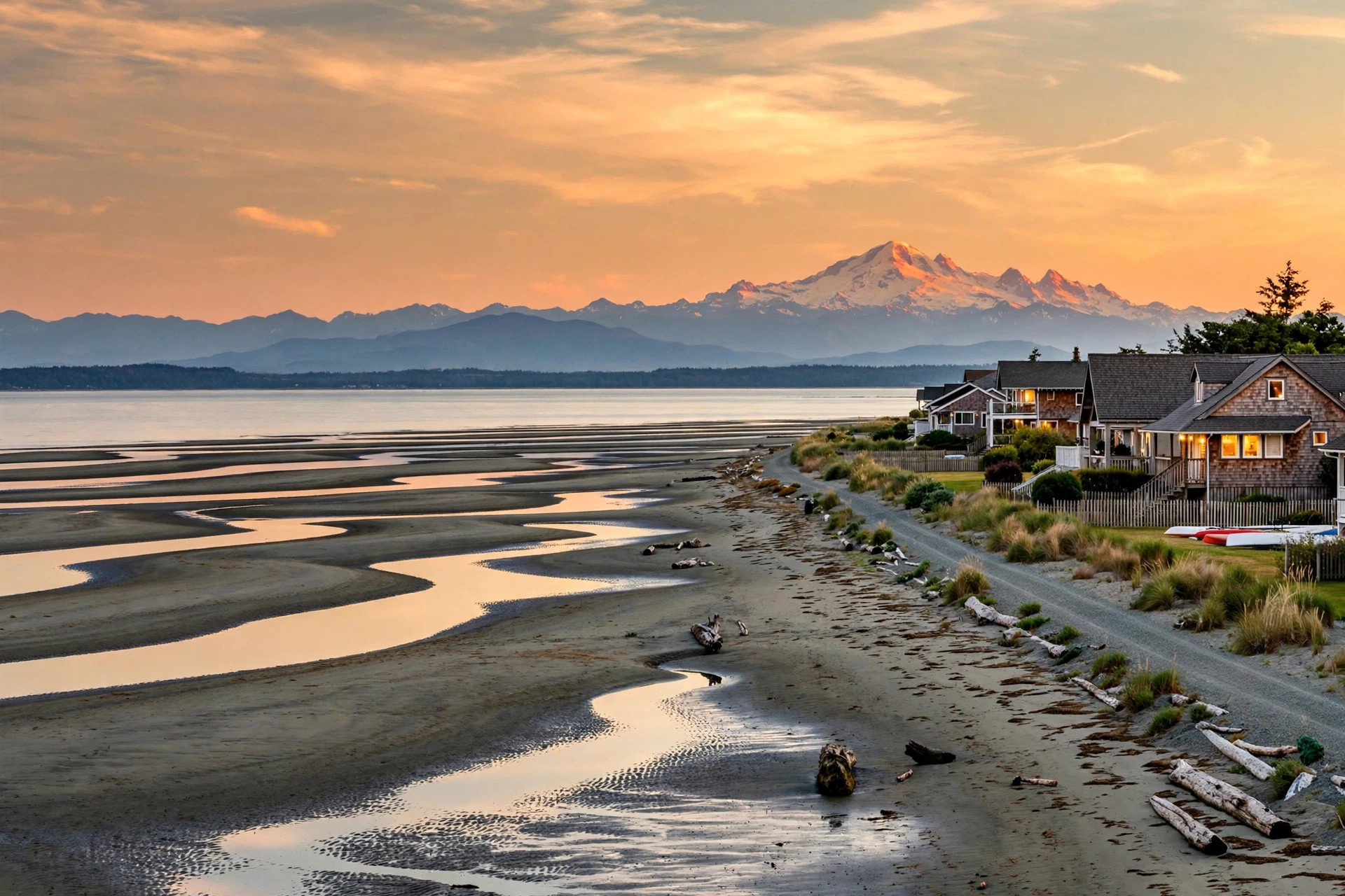
Tsawwassen is a suburban, mostly residential community on a peninsula at the southwestern corner of the City of Delta, flanked by the Strait of Georgia to the west and Boundary Bay to the east. It is one of the three communities that make up Delta - alongside Ladner and North Delta - and the smallest of the three, with about 21,600 residents at the last community-level census count (2016), within a city of 108,455 (2021 census). The name comes from the Halkomelem word meaning "land facing the sea," which tells you most of what you need to know about the place.
Tsawwassen stayed largely rural until the George Massey Tunnel opened in 1959 and put Vancouver within commuting reach. Today it has a genuine small-town feel that is rare this close to the city: locals trade on its reputation as the sunniest spot in Metro Vancouver (it sits in a rain shadow), the streets run on a simple grid around 56th Street and 12th Avenue, and the community provides the only road access to Point Roberts, Washington, the US exclave at the tip of the peninsula.
Beach Grove — The classic Tsawwassen address, on the east side of 56th Street between 12th and 17A Avenues, on the edge of Boundary Bay. Condos and townhomes overlook the Beach Grove Golf Club, detached homes sit on spacious lots, and the waterfront properties carry the premium. Grauer Park, Beach Grove Park, and the bay itself are all a short walk.
Boundary Bay — A quiet beachside neighbourhood between Boundary Bay Regional Park and the Canada-US border. It began in the 1890s as a summer cottage colony for wealthy Vancouverites; some original cottages still stand among modern waterfront homes. Centennial Beach, with its sandbars and tidal flats, is the neighbourhood beach.
English Bluff — Tsawwassen's prestige strip, along English Bluff Road on the west side. Many of the community's most expensive homes sit here, with commanding views over the Strait of Georgia to Vancouver Island. Fred Gingell Park, on the bluff, has the stairway locals call the "Tsawwassen Grind" down to Tsawwassen Beach.
Pebble Hill — Established family streets wrapped around Diefenbaker Park and Pebble Hill Park - sports fields, tennis courts, forest trails, and one of Delta's best sledding hills when it snows. Solid, well-kept single-family homes make this a first call for families.
Southlands — Tsawwassen's newest neighbourhood, built around preserved heritage farm buildings near Boundary Bay Road and 3rd Avenue. A market district with a brewery, cafes, and small shops gives it a village feel, with farmland and the Boundary Bay dyke trails as the backdrop.
Tsawwassen Springs — A golf-course community built around the Tsawwassen Golf and Country Club in the middle of town: newer condos and townhomes, a clubhouse restaurant, and an easy walk to the town centre shops on 56th Street.
The Village and Tsawwassen Heights — West-side subdivisions off English Bluff Road, overlooking the Strait. Quiet, wealthy, and view-driven, with the totem pole gateways that mark the entrance to Tsawwassen Heights.
Tsawwassen is served by School District 37 (Delta). It has one public secondary school, South Delta Secondary, and five public elementary schools: Beach Grove, Cliff Drive, English Bluff, Pebble Hill, and South Park. The private option is Southpointe Academy, a K-12 independent school in Tsawwassen.
Highway 17 runs north from Tsawwassen to Highway 99 and the George Massey Tunnel - downtown Vancouver is roughly 45-60 minutes by car, depending on tunnel traffic. For transit, the 601 bus runs all day to Bridgeport Station in Richmond for the Canada Line, with peak-hour express routes (602, 603, 604) doing the same trip faster. The Tsawwassen Ferry Terminal, on its causeway off Highway 17, sails to Swartz Bay (Victoria), Duke Point (Nanaimo), and the Southern Gulf Islands - a real quality-of-life bonus for island travellers. The Point Roberts border crossing at the foot of 56th Street is minutes away.
Water is the lifestyle here. Boundary Bay Regional Park and Centennial Beach anchor the east side - sandy beach, huge tidal flats at low tide, a playground, and dyke trails that are part of the Pacific Flyway, one of the great birdwatching corridors on the continent. On the west side, Fred Gingell Park and Diefenbaker Park cover the bluff and the sledding hill. Golfers get the Beach Grove Golf Club and Tsawwassen Springs, plus King's Links by the Sea near Boundary Bay.
Day-to-day, the town centre at 56th Street and 12th Avenue handles groceries and services, and Tsawwassen Mills - one of the largest outlet malls in BC, on Tsawwassen First Nation lands just north of town - handles the rest. The Sun Festival takes over on the BC Day long weekend in August, and the Tour de Delta bike race finishes in Tsawwassen every summer.
Tsawwassen is covered by Greater Vancouver REALTORS rather than the Fraser Valley board, so its numbers come from the Metro Vancouver report - and that report shows a slower, buyer-leaning market this fall. September saw 1,717 sales across Metro Vancouver, down 8.4% from a year ago and 25% below the ten-year September average, with 16,394 active listings, 24.3% above the ten-year average. The Metro Vancouver composite benchmark price sits at $1,075,900, down 5.5% year over year. In Tsawwassen itself, September 2026 benchmark prices were $1,508,500 for a detached home (down 1.7% from a year ago), $886,000 for a townhouse (down 8.8%), and $556,000 for an apartment (down 12.2%) - so buyers have room to negotiate, especially on townhomes and apartments. (Source: Greater Vancouver REALTORS, September 2026)
Is Tsawwassen its own city?
No - Tsawwassen is a community within the City of Delta, alongside Ladner and North Delta. The three share one municipal government, one school district (SD 37), and services like the Delta Hospital in Ladner.
Is Tsawwassen in the Fraser Valley?
It is a Lower Mainland board-boundary quirk: Tsawwassen sits in South Delta, which is covered by Greater Vancouver REALTORS, while its Delta neighbour North Delta is Fraser Valley board territory. Rohit helps buyers and sellers on both sides of that line.
Is Tsawwassen a good place to live?
If you want a quiet, beach-oriented small town within commuting distance of Vancouver, yes. It draws families for the schools and parks, and downsizers and retirees for the sunshine, the golf, and the single-level ranchers.
How long is the commute from Tsawwassen to Vancouver?
Roughly 45-60 minutes by car via Highway 17 and the George Massey Tunnel, depending on traffic. Transit riders take the 601 bus to Bridgeport Station and the Canada Line into downtown.
Is Tsawwassen more affordable than Vancouver?
Generally, yes - the detached benchmark of about $1.51 million (September 2026) sits well below Vancouver proper, and apartments and townhomes are lower still. That said, English Bluff and waterfront homes command serious premiums.
Questions about a specific Tsawwassen neighbourhood—or thinking of buying or selling here? Get in touch.
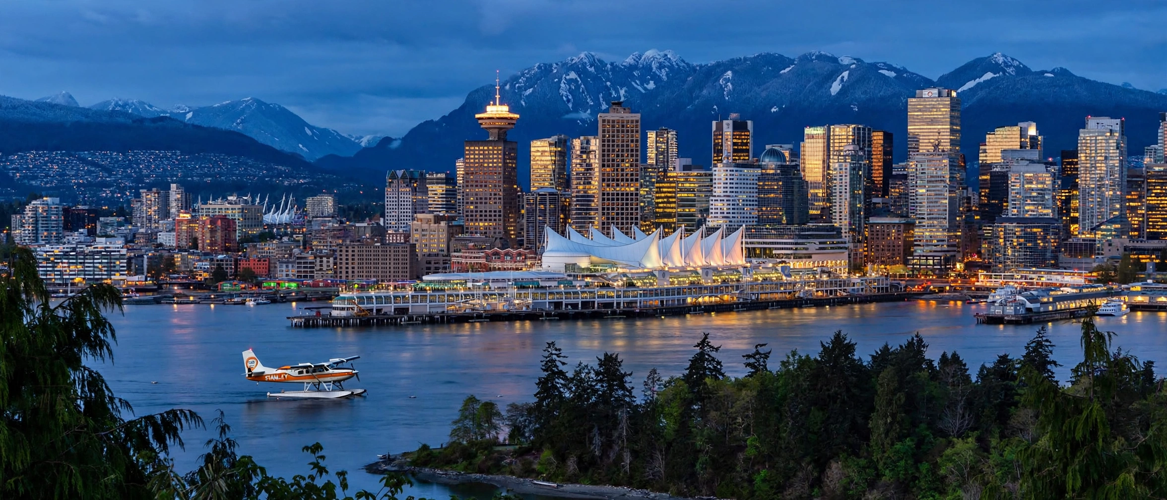
Vancouver is the largest city in British Columbia and the anchor of Metro Vancouver - 662,248 people (2021 Census) on about 115 square kilometres of land between Burrard Inlet and the Fraser River, with the Coast Mountains as a permanent backdrop. It is the city every suburb in the region measures itself against: the downtown job core, the beaches, the seawall, and some of the most expensive residential land in Canada, all inside one municipal boundary.
Locals divide the city in two at Ontario Street. Vancouver West (the West Side) runs from downtown's edge to UBC - Kitsilano, Kerrisdale, Dunbar, Point Grey - and carries the prestige addresses and the highest prices. Vancouver East (the East Side) runs from Main Street to the Burnaby border - Mount Pleasant, Commercial Drive, Hastings-Sunrise - and is known for character homes, strong high streets, and the city's more attainable entry points. The downtown peninsula sits on top of both: the financial district, Yaletown's converted warehouses, and the West End beside Stanley Park.
The city is young by world standards - incorporated in 1886, the year after the transcontinental railway chose its Burrard Inlet shore as the terminus - and it has been reinventing itself ever since: Expo 86, the 2010 Winter Olympics, and wave after wave of condo development along False Creek. What never changes is the geography. Few cities anywhere let you ski in the morning, sail in the afternoon, and walk a forest trail at the edge of downtown in between.
Downtown & Yaletown - The region's living room. Yaletown's brick warehouse conversions and False Creek seawall lofts, Coal Harbour's glass towers facing the harbour and floatplanes, and the West End's leafy, rental-and-condo streets beside Stanley Park and English Bay. This is condo living at its most urban - walk everywhere, own little grass, and let the city be the amenity.
Kitsilano - The West Side beach neighbourhood. Kits Beach, West 4th Avenue's shops and cafes, and a mix of character houses, duplexes, and low-rise condos a few minutes from downtown across the Burrard Bridge. Yoga-studio energy, mountain views from the sand, and some of the most fought-over listings in the city every spring.
Point Grey & Dunbar - Vancouver's prestige west. Wide, quiet streets, large homes, and top-ranked schools under a canopy of mature trees, running from West 10th Avenue's village shops to the UBC lands at the city's tip. Detached benchmarks here are among the highest in the country; the draw is space, privacy, and Pacific Spirit Park's forest trails at the door.
Kerrisdale - A village inside the city, centred on West 41st Avenue: bakeries, bookstores, and long-established family homes on generous, flat lots. Heritage character, strong schools, and a quieter pace than Kitsilano - a long-time favourite for families who want West Side roots without the beach-scene premium.
Mount Pleasant & Main Street - The East Side's creative core. Heritage homes and new low-rise condos around Main Street's independent shops, breweries, and restaurants, with the Olympic Village and Science World end of False Creek at its north edge. Younger buyers start here: character, walkability, and two SkyTrain lines within reach.
Commercial Drive / Grandview-Woodland - "The Drive" - Vancouver's most storied high street, built by generations of Italian, Portuguese, and Latin American families and still full of delis, espresso bars, and small theatres. Character houses and duplexes on the side streets, SkyTrain at Commercial-Broadway, and a community feel no new development has managed to copy.
Hastings-Sunrise - The East Side's family value pick. An established, village-scaled neighbourhood along East Hastings - the PNE and Hastings Park in its middle, New Brighton Park on the inlet, and detached homes and duplexes priced well below the West Side. Quietly discovered by first-time buyers priced out of Mount Pleasant.
Vancouver is served by the Vancouver School Board (School District 39), the largest district in BC. Well-known secondaries include Lord Byng and Point Grey Secondary on the West Side, Kitsilano Secondary, Vancouver Technical and Britannia Secondary on the East Side, and John Oliver Secondary in the south, with French immersion, International Baccalaureate, and mini-school programs spread across the city. The University of British Columbia sits at the city's western tip (on the University Endowment Lands at Point Grey), and Simon Fraser University runs its downtown campus at Harbour Centre. Langara College serves the south side, and Emily Carr University anchors the False Creek flats.
Vancouver is the hub every regional line points at. Three SkyTrain lines meet downtown: the Expo Line east through Burnaby to Surrey, the Millennium Line through Commercial-Broadway to Coquitlam and (via Lougheed) Port Moody, and the Canada Line south to Richmond and YVR Airport - about 25 minutes from Waterfront to the airport. The SeaBus crosses Burrard Inlet to North Vancouver in about 12 minutes, and the West Coast Express runs weekday peak trains from Mission through the Tri-Cities to Waterfront. Drivers cross to the North Shore on the Lions Gate and Ironworkers Memorial bridges, south to Richmond on the Oak and Knight Street bridges, and east on Highway 1 from the city's eastern edge.
Start with the seawall - roughly 28 kilometres of waterfront path wrapping Stanley Park, False Creek, and the beaches, with Stanley Park itself offering about 1,000 acres of rainforest, trails, and beaches at the edge of downtown. Summer belongs to the beaches: Kits Beach, English Bay, Jericho, and Spanish Banks. Granville Island's public market is the city's pantry, the Vancouver Art Gallery and the Museum of Anthropology at UBC cover the culture side, and Grouse Mountain and Cypress Mountain are a short drive across the harbour for skiing and hiking. Day to day, the city's real luxury is its high streets - Commercial Drive, Main Street, West 4th, South Granville, Kerrisdale Village - each neighbourhood shopping on its own main street instead of a mall.
The Vancouver board reports the city in two halves - Vancouver West and Vancouver East - rather than as one market, because the two halves behave like different cities. Metro Vancouver as a whole recorded 1,717 sales in September 2026, down 8.4% from a year ago, with 16,394 active listings and a composite benchmark of $1,075,900, down 5.5% year over year. Inside the city, September saw 489 sales and 1,906 new listings - 183 sales on the East Side and 306 on the West Side, where downtown apartments do the heavy lifting.
The price split tells the story. Composite benchmarks sit at $1,206,600 on the West Side (down 5.3% year over year) and $1,120,200 on the East Side (down 5.0%). For detached homes the gap is dramatic: $2,916,100 on the West Side (down 8.7%) against $1,630,500 on the East Side (down 7.7%). Townhouses benchmark at $1,298,500 West (down 5.5%) and $980,400 East (down 7.9%), and apartments at $761,800 West and $634,800 East (both down 5.2%). The story for buyers: the softest segment region-wide is apartments, and Vancouver's hundreds of condo listings - especially downtown and on the East Side - are where the negotiating room is this fall. (Source: Greater Vancouver REALTORS, September 2026)
What is the difference between Vancouver West and Vancouver East?
The board splits the city at Ontario Street. Vancouver West (the West Side, out to UBC) carries the prestige neighbourhoods and the highest prices; Vancouver East (the East Side, to the Burnaby border) offers character homes and the city's lower entry points. Same city, two very different markets.
How long is the commute from Vancouver to the airport or the suburbs?
The Canada Line reaches YVR Airport in about 25 minutes from Waterfront Station. SkyTrain puts Burnaby at roughly 20 minutes, Richmond at about 25, and Surrey City Centre at about 45 on the Expo Line.
Where is the most affordable way into the Vancouver market?
On September 2026 benchmarks, East Side apartments (about $634,800) and East Side townhouses (about $980,400) are the city's main entry points, with Hastings-Sunrise and Commercial Drive among the first areas buyers look at.
Is downtown Vancouver only condos?
Essentially, yes - the downtown peninsula is apartments and townhouse-style podium units. Detached homes start in the surrounding neighbourhoods: Kitsilano and Mount Pleasant on the inner edges, then the West Side and East Side proper.
Questions about a specific Vancouver neighbourhood — or thinking of buying or selling here? Get in touch.
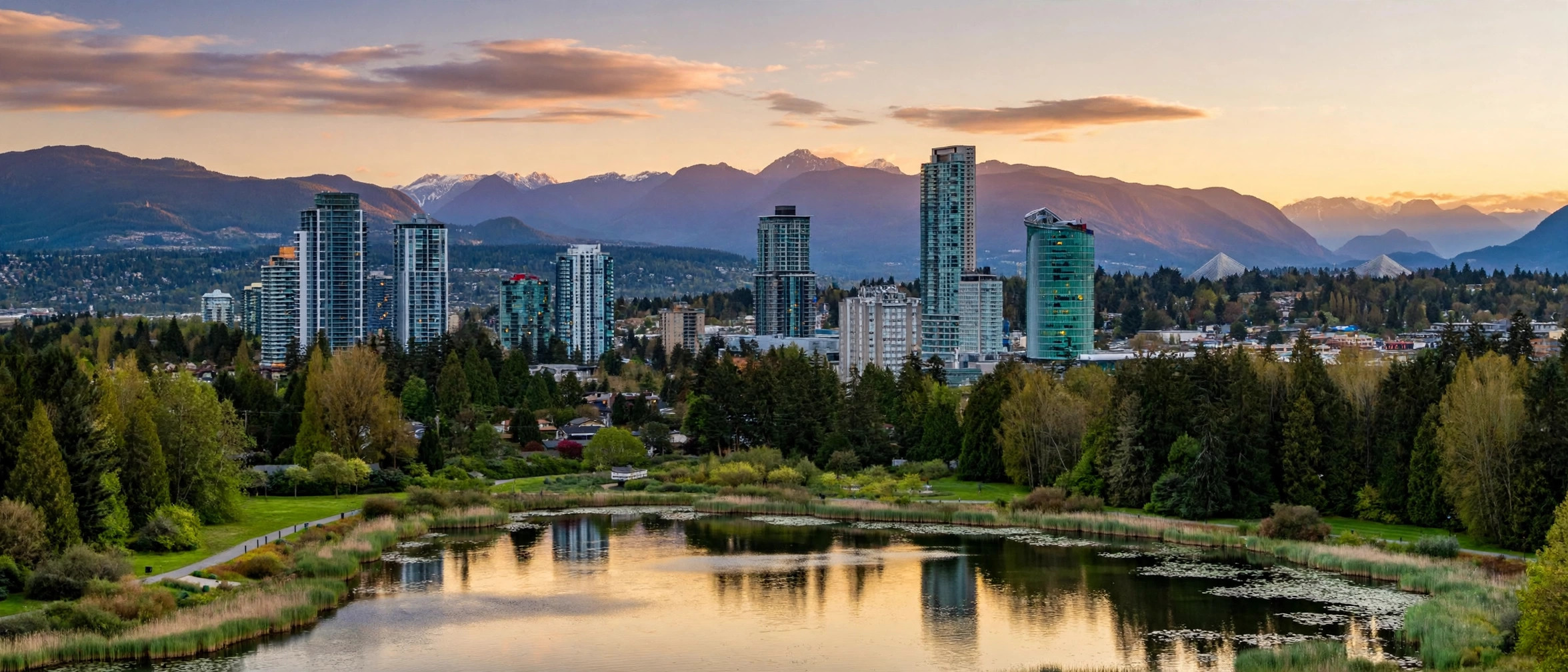
Burnaby is British Columbia's third-largest city - 249,125 people (2021 Census) on about 90.6 square kilometres at the centre of the Burrard Peninsula, with Vancouver to the west, Coquitlam and Port Moody to the east, New Westminster across the Fraser River to the southeast, and Burrard Inlet to the north. Incorporated in 1892 and a city since 1992, it is also the seat of Metro Vancouver's regional district government. Roughly a quarter of the city's land is parks and open space, which is why a city known for condo towers still feels green from most streets.
Burnaby is really four town centres joined by SkyTrain - Metrotown, Brentwood, Edmonds and Lougheed - each with its own station, mall or high street, and tower cluster, surrounded by older detached neighbourhoods that have barely changed in decades. That split is the whole story for buyers: a downtown-style condo life at a town centre, or a detached home with a yard a ten-minute bus ride away, inside the same municipal boundary. The main campuses of Simon Fraser University and the British Columbia Institute of Technology are both here, and the city is a major hub for film and television production.
Metrotown - Burnaby's downtown in practice. Metropolis at Metrotown, the largest mall in British Columbia, plus Station Square and Crystal Mall, sit right on the Expo Line at Metrotown station, surrounded by the region's densest cluster of condo towers. This is the most urban address in the city: walk to everything, ride SkyTrain everywhere, and trade yard space for a skyline view.
Brentwood - The fastest-changing corner of Burnaby. Around Brentwood Town Centre station on the Millennium Line, older low-rise blocks are giving way to new towers, shops and restaurants, with the Heights and Capitol Hill's detached streets a short walk away. Buyers here are betting on the town centre still being built around them.
Burnaby Heights (The Heights) - The village high street on Hastings Street in the city's northeast. Italian roots, delis and restaurants, character homes on the side streets, and views across the inlet from the top of the hill. One of the few Burnaby neighbourhoods that still feels like a small town, with the Millennium Line a bus ride away rather than at the door.
Edmonds - South Burnaby's family neighbourhood, centred on Edmonds station on the Expo Line. A mix of condos, townhouses and detached homes on the south slope, with the Fraser River flats below and Metrotown one stop west. Often the first area Burnaby buyers look when Metrotown prices stretch too far.
Lougheed - Where the two SkyTrain lines meet. Lougheed Town Centre station is served by both the Expo and Millennium Lines, with Burnaby Lake's trails nearby and a mix of new towers and established townhouse complexes. The practical pick for commuters who want two directions of travel.
Deer Lake - Park-side living around Deer Lake Park, home to the Burnaby Art Gallery, the Burnaby Village Museum and the Shadbolt Centre. Detached homes on quiet, treed streets beside the lake's trails, a short drive from Metrotown and Burnaby Central Secondary. The closest thing in Burnaby to country living inside the city.
Burnaby Mountain - The university neighbourhood. Simon Fraser University's main campus sits on top of Burnaby Mountain, with the University Highlands townhouse community below it and Burnaby Mountain Park's trails and inlet views at the door. A distinct market of its own: student rentals, faculty homes, and townhouses with a view.
Capitol Hill and the South Slope - The detached backbone of the city. Capitol Hill's quiet residential streets in the north and the South Slope's family homes above the Fraser River in the south are where Burnaby's long-time homeowners live - larger lots, mature trees, and prices that still sit below Vancouver's for the same house.
Burnaby is served by Burnaby School District 41. Well-known secondaries include Burnaby North Secondary and Burnaby South Secondary, Burnaby Central Secondary beside Deer Lake, Burnaby Mountain Secondary, Moscrop Secondary, Alpha Secondary, Byrne Creek Community School and Cariboo Hill Secondary. Post-secondary is a local strength: Simon Fraser University's main campus is on Burnaby Mountain, and the British Columbia Institute of Technology's main campus is in the city, with both drawing students who rent across Burnaby's town centres.
Burnaby is the city both SkyTrain lines run through. The Expo Line stops at Patterson, Metrotown, Royal Oak and Edmonds on its way from downtown Vancouver to Surrey, and the Millennium Line stops at Gilmore, Brentwood Town Centre, Holdom, Sperling-Burnaby Lake and Lake City Way on its way to Coquitlam. Lougheed Town Centre and Production Way-University are served by both lines. TransLink's station-to-station times put Metrotown about 20 minutes from Waterfront Station in downtown Vancouver on the Expo Line. Drivers take Highway 1, which runs east-west through the city, to Vancouver, the Tri-Cities and the Fraser Valley, and cross to the North Shore on the Ironworkers Memorial Bridge.
Start with the parks. Deer Lake Park offers lakeside trails and the city's cultural cluster, Burnaby Lake is a bird sanctuary with a long perimeter trail, Central Park holds Swangard Stadium and forested paths in the middle of the city, and Burnaby Mountain Park gives inlet views and a trail network above it all. For shopping, Metropolis at Metrotown is the largest mall in the province, Brentwood's new retail streets are catching up fast, and The Heights' Hastings Street is the independent alternative. Day to day, Burnaby's luxury is the split itself: a tower condo with a SkyTrain at the door, or a detached home beside a lake, without leaving the city.
Burnaby is reported as three areas - Burnaby East, Burnaby North and Burnaby South - rather than as one market, because the three areas price differently. Metro Vancouver as a whole recorded 1,717 sales in September 2026, down 8.4% from a year ago, with 16,394 active listings and a composite benchmark of $1,075,900, down 5.5% year over year. Inside Burnaby, September saw 207 sales and 656 new listings - 50 detached sales against 146 new detached listings, 36 attached sales against 137 new attached listings, and 121 apartment sales against 373 new apartment listings.
The price split tells the story. Composite benchmarks sit at $982,400 in the East (down 6.3% year over year), $877,100 in the North (down 7.4%) and $972,800 in the South (down 7.2%). For detached homes the gap runs the other way: $1,894,600 in the South (down 10.3%) against $1,808,500 in the North (down 9.2%) and $1,694,900 in the East (down 6.7%). Townhouses benchmark at $942,100 in the South (down 4.9%), $880,400 in the North (down 4.7%) and $857,900 in the East (down 1.7%), and apartments at $723,000 in the South (down 8.3%), $708,100 in the East (down 5.5%) and $662,400 in the North (down 6.6%). The story for buyers: apartments are the softest segment, so the negotiating room this fall is in apartments. (Source: Greater Vancouver REALTORS, September 2026)
What is the difference between Burnaby East, Burnaby North and Burnaby South?
They are the board's three price areas, roughly dividing the city into north, south and east sections. The North carries the lowest composite benchmark ($877,100) and the Brentwood and Heights neighbourhoods; the South carries the highest detached benchmark ($1,894,600) and Metrotown and Edmonds; the East carries the lowest detached benchmark ($1,694,900) and the Lougheed side of the city. Same city, three different price pictures.
How long is the commute from Burnaby to downtown Vancouver?
TransLink puts Metrotown about 20 minutes from Waterfront Station on the Expo Line, with no transfers. Brentwood rides the Millennium Line and transfers at Commercial-Broadway or Lougheed Town Centre, and drivers take Highway 1 west into the city.
Where is the most affordable way into the Burnaby market?
On September 2026 benchmarks, North Burnaby apartments (about $662,400) are the city's main entry point, followed by East Burnaby apartments (about $708,100) and East Burnaby townhouses (about $857,900). Edmonds and the Lougheed area are among the first places buyers look.
Is Burnaby all condo towers?
No - the towers cluster at the four town centres. Away from them, the South Slope, Capitol Hill, the Heights and the Burnaby Mountain area are detached and townhouse neighbourhoods with yards, mature trees and long-time owners.
Questions about a specific Burnaby neighbourhood — or thinking of buying or selling here? Get in touch.
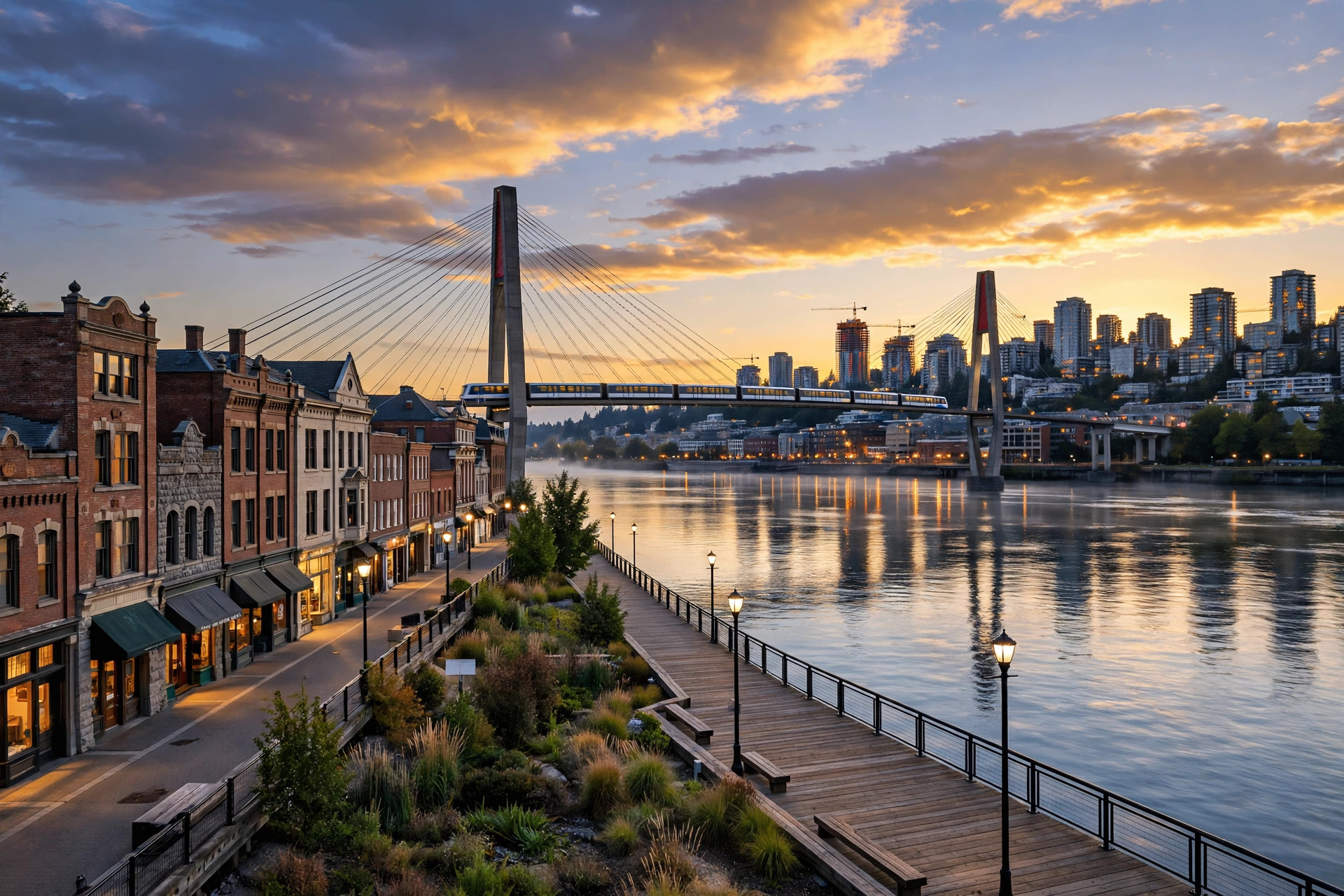
New Westminster - "New West" to locals - is a city on the north bank of the Fraser River, roughly at the centre of Metro Vancouver and about 19 kilometres southeast of downtown Vancouver. It packs 78,916 people (2021 Census) into just 15.62 square kilometres, making it the second-densest municipality in Canada. Small footprint, big history, and one of the region's oldest urban cores.
The city was founded in 1858 by Colonel Richard Clement Moody and the Royal Engineers as the capital of the Colony of British Columbia. Queen Victoria named it after Westminster in London - the source of its nickname, "the Royal City" - and in 1860 it became the first city incorporated in British Columbia. The capital moved to Victoria after the colonies united in 1866, but New West kept its heritage downtown, its riverfront, and its role as a crossroads city. Today it pairs that history with some of the best transit access in the suburbs and a fast-growing skyline around its SkyTrain stations.
Downtown - The historic core: Columbia Street's "golden mile" of heritage storefronts (long famous for its bridal shops), the Anvil Centre, the River Market, and Westminster Pier Park on the river. High-rise condos cluster around New Westminster Station - the most urban living in the city.
Quayside - A planned waterfront community along the Fraser River boardwalk, west of downtown. Almost entirely condos and townhomes, built for river views and an evening stroll along the water. Quiet, strata-focused, and popular with downsizers and first-time buyers.
Uptown - The city's everyday commercial heart, around Sixth Street and Sixth Avenue: Royal City Centre mall, shops and services, Moody Park, and the main library. A mix of older single-family streets, low-rise condos, and newer mid-rise buildings.
Brow of the Hill and Queen's Park - The heritage showpiece. Grand character homes on tree-lined streets above the river, wrapped around Queen's Park - one of BC's oldest municipal parks, with its rose garden, sports fields, and arena. Glenbrooke North's quiet streets sit just north of the park.
Sapperton - A historic working neighbourhood at the city's east end, home to Royal Columbian Hospital and the Brewery District's newer condos and shops. Sapperton and Braid SkyTrain stations make it a commuter favourite, and Sapperton Landing opens up the riverfront.
Queensborough - New West's island neighbourhood, on the eastern tip of Lulu Island across the Queensborough Bridge. A fast-growing, family-first community: newer subdivisions at Port Royal, older homes on the flats, Queensborough Landing shopping, and a strong community-centre culture.
Massey Victory Heights - The residential east end: established family streets, many with views over the Fraser, close to Highway 1. A quieter, more suburban feel than the downtown core.
New Westminster is served by School District 40 (New Westminster Schools) - a single-secondary-school district built around New Westminster Secondary School, one of the largest high schools in BC, whose replacement building opened in 2021. Elementary and middle schools include Queen Elizabeth, F.W. Howay, Lord Kelvin, Herbert Spencer, Glenbrook, and Queensborough's Queen Elizabeth Elementary and Queensborough Middle School. For post-secondary, Douglas College's main campus is downtown, and the Justice Institute of BC is headquartered in the city.
New Westminster is the best-connected suburb in the region. Five SkyTrain stations - 22nd Street, New Westminster, Columbia, Sapperton, and Braid - put downtown Vancouver about 30 minutes away by Expo Line. Drivers get Highway 1 across the Port Mann Bridge, the Pattullo Bridge into Surrey, Highway 91A over the Queensborough Bridge, and Kingsway straight into Burnaby and Vancouver. Royal Columbian Hospital, one of BC's busiest trauma centres, is also one of the city's biggest employers - plenty of residents work where they live.
The Fraser River is the front room. Westminster Pier Park and the Quayside boardwalk run along the water, the River Market covers food and local shops at the Quay, and Front Street and Columbia Street give the downtown a heritage feel no other suburb matches - plus film shoots and the Hyack Festival every May. Queen's Park anchors the green space: rose garden, playing fields, and the Queen's Park Arena. The Anvil Centre adds a theatre and conference centre downtown, and Tipperary Park hosts the farmers market beside City Hall.
New Westminster is covered by Greater Vancouver REALTORS rather than the Fraser Valley board, so its numbers come from the Metro Vancouver report - a slower, buyer-leaning market this fall. Metro Vancouver recorded 1,717 sales in September 2026, down 8.4% from a year ago and 25% below the ten-year September average, with 16,394 active listings. New Westminster's September 2026 benchmark prices: detached homes at $1,356,900 (down 10.4% from a year ago), townhouses at $854,200 (down 6.8%), and apartments at $579,900 (down 7.5%). That apartment number is the story - New West remains one of the most affordable SkyTrain-connected communities in the region, which is exactly why first-time buyers and investors keep it on their list. (Source: Greater Vancouver REALTORS, September 2026)
Is New Westminster its own city?
Yes - and an original one. Founded in 1858 as the capital of the Colony of British Columbia, it was the first city incorporated in BC (1860). It is a standalone municipality in Metro Vancouver, bordered by Burnaby, Coquitlam, Surrey, and Delta.
Why is it called the Royal City?
Queen Victoria named the city after Westminster, London, in 1859 - rejecting the original suggestion of "Queensborough" (a name that survives today as the Queensborough neighbourhood).
How long is the commute from New Westminster to downtown Vancouver?
About 30 minutes by SkyTrain on the Expo Line - the city has five stations. Driving varies with bridge traffic on Highway 1 and Kingsway.
Is New Westminster good for first-time buyers?
It is one of the strongest first-time-buyer plays in the region: an apartment benchmark of about $579,900 (September 2026), genuine walkability, and SkyTrain access without a Vancouver price tag.
Which New Westminster neighbourhood is best for families?
Queensborough and Massey Victory Heights are the classic picks - newer and established family homes respectively, with community centres and parks. Brow of the Hill and Queen's Park suit buyers who want heritage character on quiet streets.
Questions about a specific New Westminster neighbourhood—or thinking of buying or selling here? Get in touch.
Port Coquitlam - PoCo to locals - is the Tri-Cities' value play: 61,498 people (2021 Census) on about 29 square kilometres where the Pitt and Coquitlam Rivers meet, between Coquitlam to the west and Pitt Meadows across the Pitt River. Incorporated as a city in 1913 around the Canadian Pacific Railway's Westminster Junction terminus, it grew from farmland into a family suburb without losing its small-town downtown, and it still prices below both of its Tri-Cities neighbours for a comparable home - more space per dollar, which is why first-time and move-up buyers keep landing here.
The city's identity is written outdoors. The Traboulay PoCo Trail loops about 25 kilometres around the whole community - along the Pitt River on both the south and north sides, up the Coquitlam River, past Hyde Creek and DeBoville Slough - and the city counts some 275 hectares of parkland inside its boundary. Add a West Coast Express station downtown and a genuine main street on Shaughnessy Street, and PoCo reads as the Tri-Cities option for buyers who want trails at the door and a train to downtown Vancouver, without the Coquitlam or Port Moody price tag.
Downtown Port Coquitlam - The historic heart on Shaughnessy Street, around Leigh Square and the Terry Fox Hometown Square. Brick storefronts, restaurants, the community centre and the West Coast Express station, with condos and townhouses filling in around it. The most walkable address in the city, and the one with the train at the door.
Citadel - The hillside neighbourhood in the city's north, known for its views and Castle Park. Larger, newer detached homes on the slopes above the city, with trails nearby and the strongest school cachet in PoCo. The top of the local detached market.
Mary Hill - The established neighbourhood on the south side, close to the Mary Hill Bypass and the Pitt River crossings. A mix of older detached homes and townhouses, popular with commuters for the quick hop to the highway network. The practical family pick.
Riverwood - The newer neighbourhood in the northeast, built around Blakeburn Lagoons Park. Contemporary detached homes and townhouses beside the lagoons and trails, drawing young families who want a new build without leaving the Tri-Cities.
Oxford Heights - The value corner in the city's west, near the Coquitlam border and the Coquitlam River. Parks, townhouses and detached homes at prices that undercut the rest of PoCo, with the Millennium Line at Coquitlam Central a short ride away.
Port Coquitlam is served by School District 43 (Coquitlam), the Tri-Cities' district and one of the largest in the province. Well-known secondaries in the city include Terry Fox Secondary - named for the hometown hero whose Marathon of Hope started here - and Riverside Secondary in the Riverwood area. French immersion options run through the district, and the city's family appeal rests heavily on this school picture.
Port Coquitlam's headline commute is the West Coast Express: weekday peak trains run from Port Coquitlam Station downtown to Waterfront Station in about 40 minutes. There is no SkyTrain station inside the city - the nearest is Coquitlam Central on the Millennium Line's Evergreen Extension, a short bus ride or drive away, with frequent bus connections from the PoCo station exchange. Drivers take the Lougheed Highway west to Coquitlam and Vancouver or east toward Maple Ridge, and the Mary Hill Bypass to the Pitt River Bridge and Highway 7.
Start with the trail. The Traboulay PoCo Trail is the city's signature outdoor asset - a roughly 25-kilometre loop for walking, cycling and skating that touches the Pitt River, the Coquitlam River, Hyde Creek and DeBoville Slough. Blakeburn Lagoons Park in Riverwood is the bird-watching stop, Gates Park and Lions Park anchor the sports fields, and downtown's Leigh Square hosts community events through the year. PoCo's calendar peaks with May Days, the spring festival celebrated since 1923, and the Terry Fox Hometown Run, which starts at Hyde Creek and honours the city's most famous son. Day to day, the lifestyle pitch is simple: a river trail at the end of the street, a real downtown, and a train to the city.
Metro Vancouver as a whole recorded 1,717 sales in September 2026, down 8.4% from a year ago, with 16,394 active listings and a composite benchmark of $1,075,900, down 5.5% year over year. Inside Port Coquitlam, September saw 55 sales against 186 new listings - 26 detached sales against 52 new detached listings, 16 attached sales against 54 new attached listings, and 13 apartment sales against 80 new apartment listings.
Benchmarks tell a buyer's-market story across all three segments. The composite sits at $835,500, down 8.2% year over year. Detached homes benchmark at $1,240,600, down 8.5% - back to roughly 2021 pricing, even as detached sales picked up to their busiest month of 2026 alongside April. Townhouses benchmark at $834,300, down 7.8%, with sales holding up better than the price trend suggests. Apartments benchmark at $550,000, down 9.0%, and had the softest month of the three - the negotiating room this fall is in apartments. (Source: Greater Vancouver REALTORS, September 2026)
Is Port Coquitlam part of the Fraser Valley?
No - it is a Metro Vancouver municipality in the Tri-Cities, covered by Greater Vancouver REALTORS rather than the Fraser Valley Real Estate Board. It sits just west of the Fraser Valley boundary, which is part of why it prices below Valley suburbs for a similar home.
How long is the commute from Port Coquitlam to downtown Vancouver?
About 40 minutes on the West Coast Express from Port Coquitlam Station to Waterfront Station during weekday peak hours. By car it is longer and traffic-dependent; by transit you can also bus to Coquitlam Central and take the Millennium Line.
Is there SkyTrain in Port Coquitlam?
Not inside the city. The nearest station is Coquitlam Central on the Millennium Line, a short bus ride from the PoCo station exchange, and the northern neighbourhoods sit closest to it.
Where is the most affordable way into the Port Coquitlam market?
On September 2026 benchmarks, apartments (about $550,000) are the entry point, followed by townhouses (about $834,300). Oxford Heights and the downtown condo stock are among the first places buyers look.
Questions about a specific Port Coquitlam neighbourhood — or thinking of buying or selling here? Get in touch.